A Local’s Guide to Spending 3 Days Around Oak Bay, Vancouver Island

If you’re spending time in Victoria on Vancouver Island and are looking for places to visit outside of the downtown hub, this guide is for you. For those that enjoy recreation and nature and don’t have a car, there are several interesting neighbourhoods to explore on foot outide of the city centre.

Located on the traditional Indigenous lands of the Songhees Nations, the localities of Gonzales, Oak Bay, and Uplands can all be considered affluent neighbourhoods. With leafy streets, pretty parks, ocean views, and sandy beaches, they are pleasant areas in which to unwind and enjoy island living.

Read on for ideas on how to spend 3 days in these picturesque neighbourhoods.

Day 1:

After enjoying a sleep-in, head to Good Earth Coffeehouse on Oak Bay Ave for a quick breakfast. It’s here that a friend introduced me to vanilla rooibos lattes. I’m not a huge tea drinker but these are delicious if you’re looking for something without caffeine.

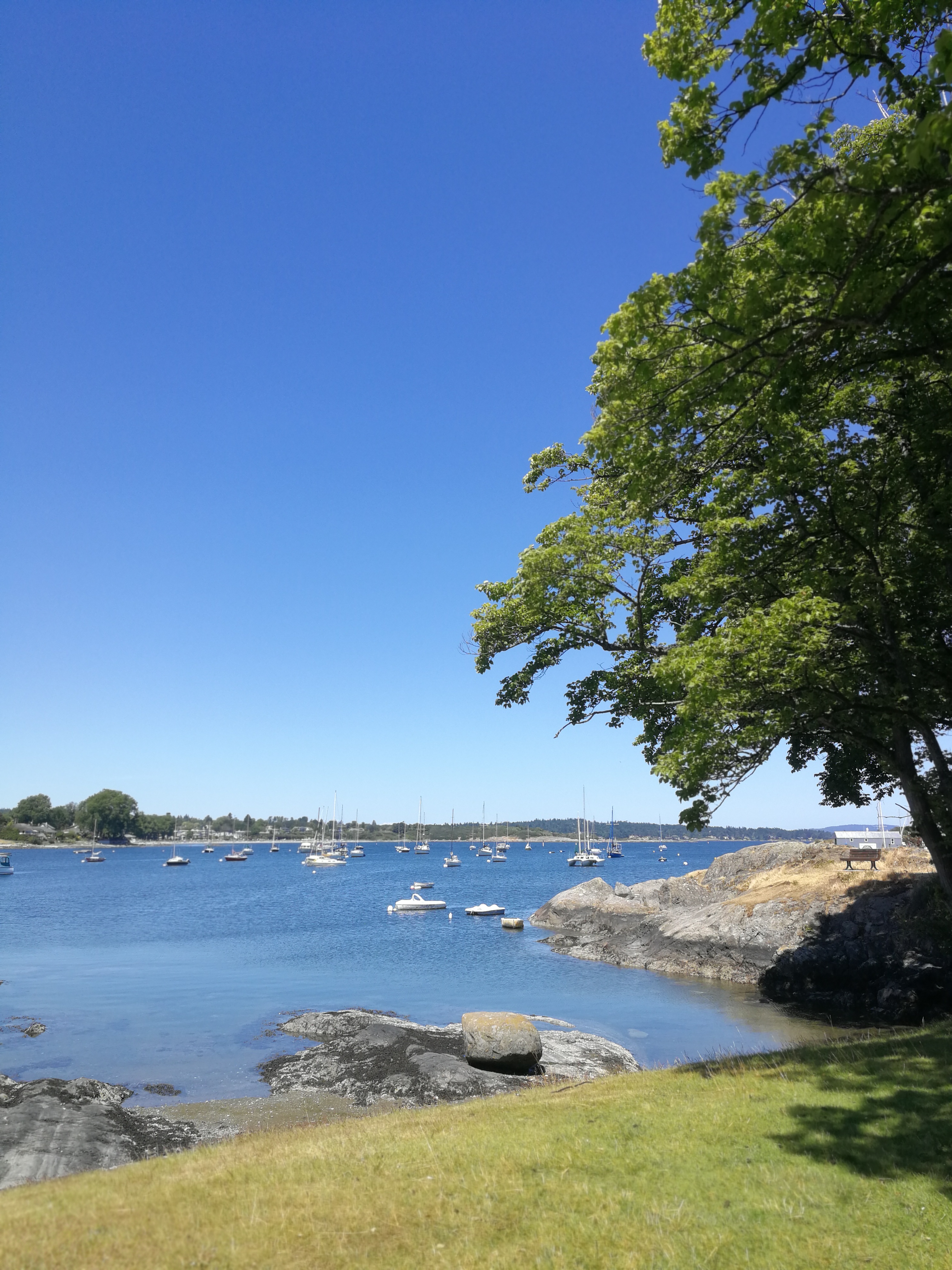
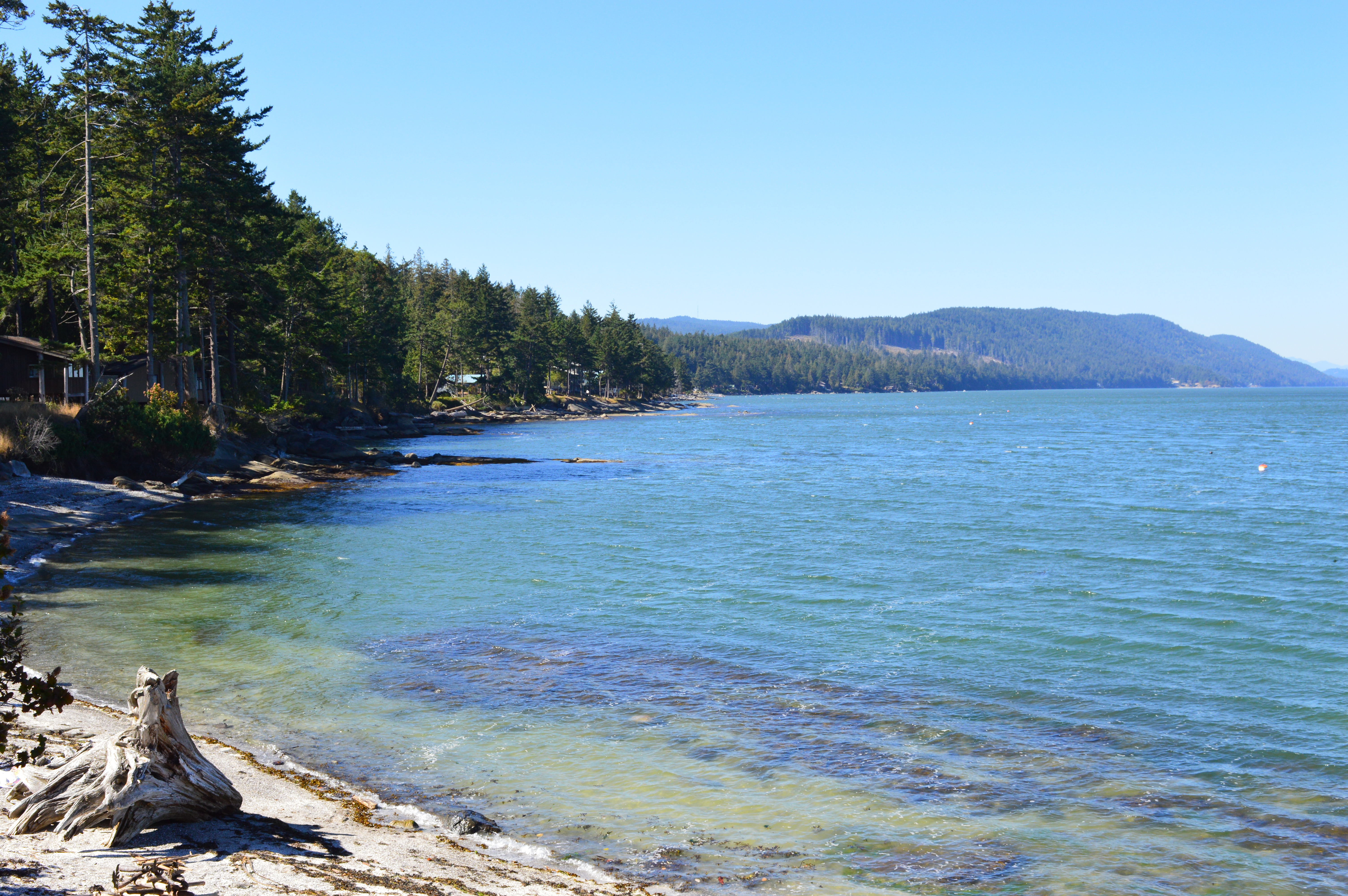
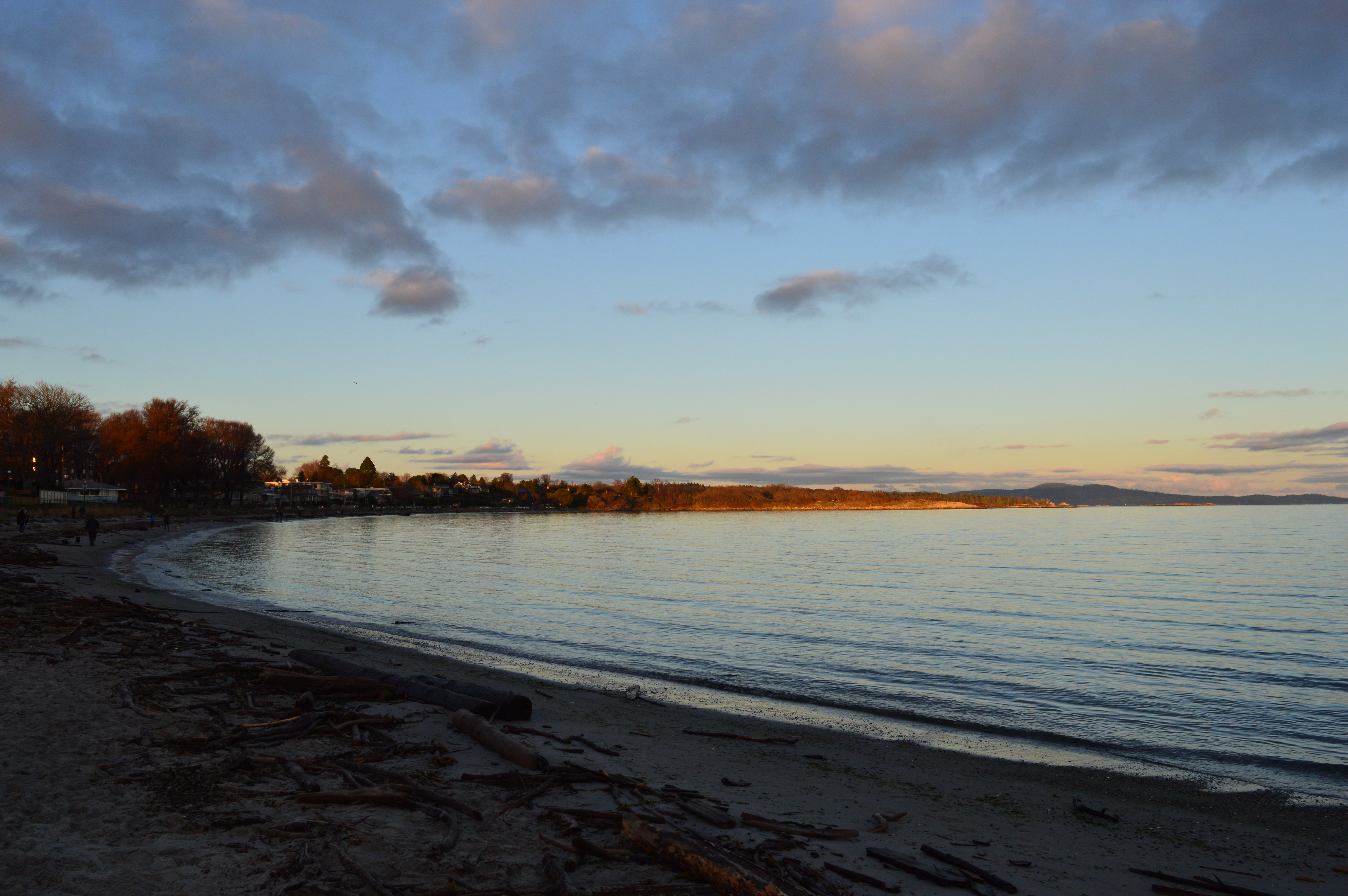
After breakfast, walk down Foul Bay Road, admiring the grand houses and saying hello to the deer that can often be found snacking on someone’s lawn. At Crescent Road, cross the crosswalk and turn left. Shortly on the right, there’ll be a small parking area. Some stairs lead down to Gonzales Bay, a sandy beach that makes a good spot for an ocean dip and ball games. If you were to wake up and see this beach for the first time, you’d be forgiven for thinking you were in California. The sight of snow-capped mountains in the distance across the ocean will remind you that you’re further north! I recommend visiting Gonzales Bay on a weekday as it’s a very popular beach during summer weekends.

Gonzales Bay

After you’ve had your fill of beach time, head back to Crescent Road and continue right. The road becomes King George Terrace as you walk up a hill that winds to the right. After a couple hundred metres, you’ll come to a rest area with parking spaces. If you feel like it, follow the path down to Trafalgar Park for a breezy view of the ocean.

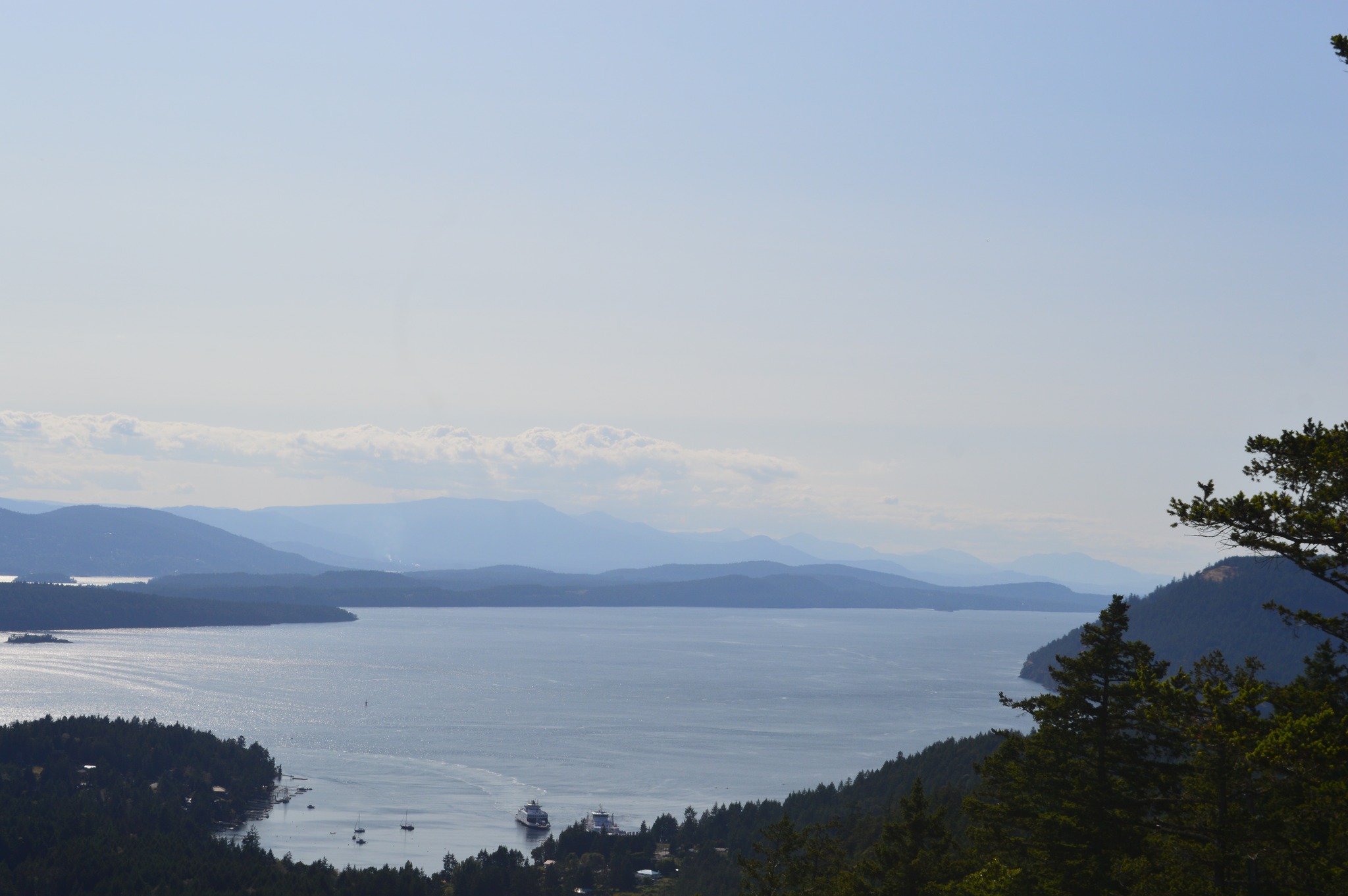
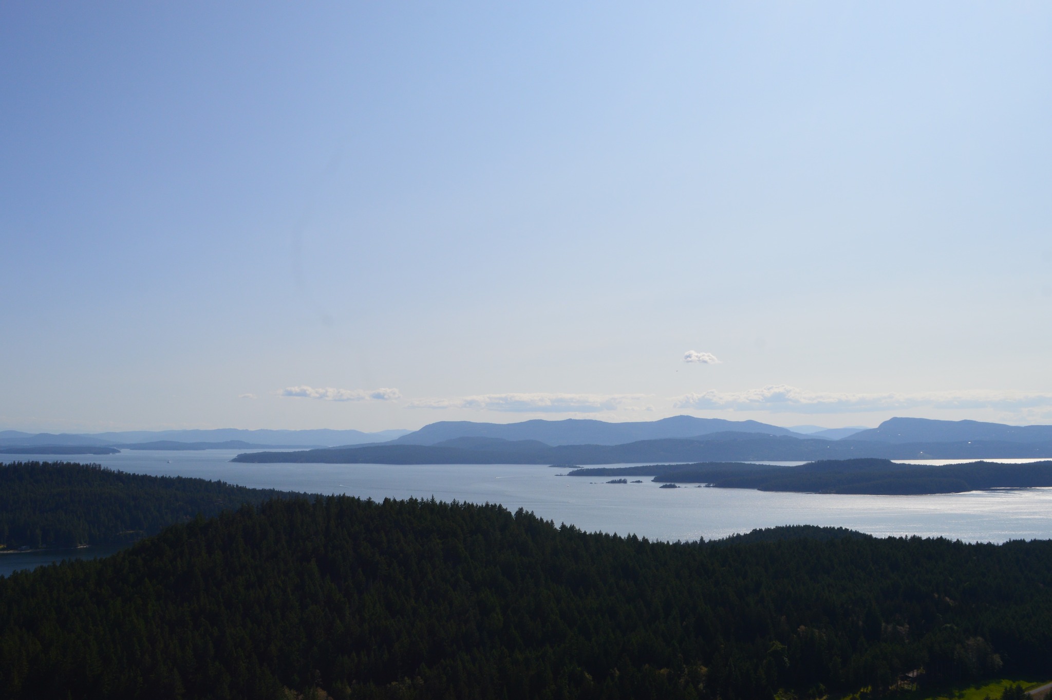
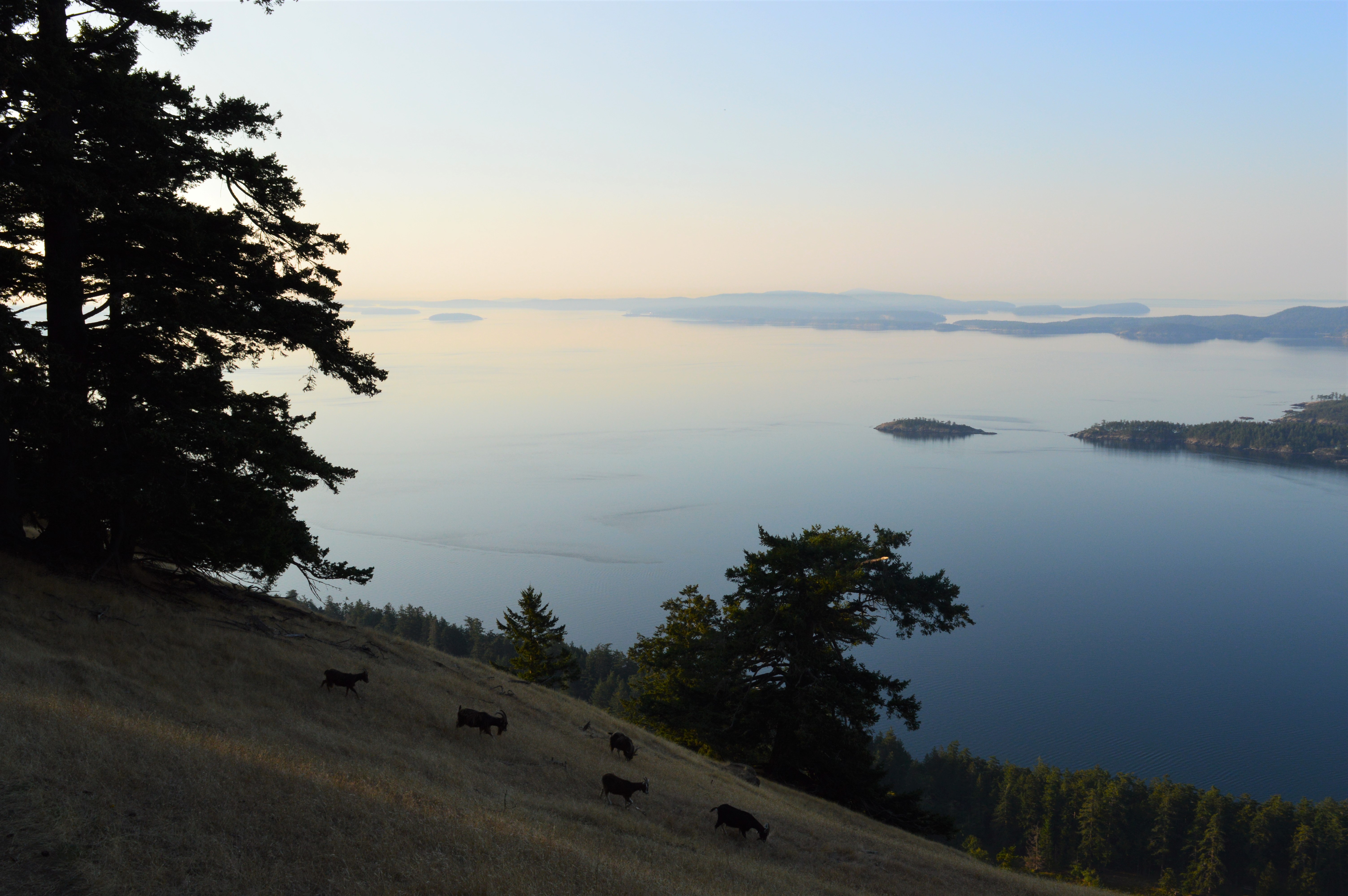
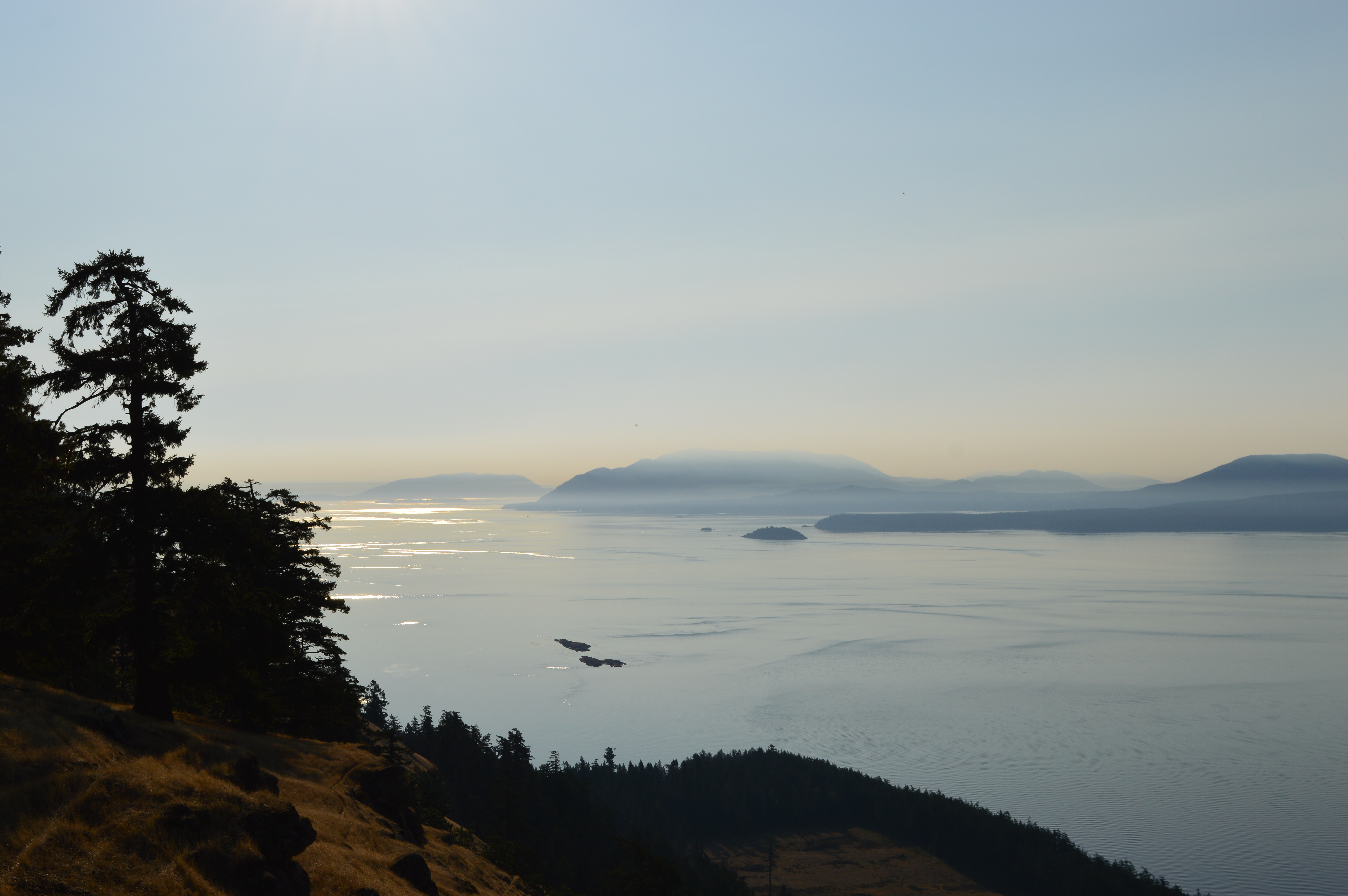
From here, continue along King George Terrace as it winds downhill. Once the road flattens and it’s safe to do so, you’ll want to cross to the other side. Just next to the start of Sunny Lane is a narrow footpath that leads up to Walbran Park. The path involves a set of stairs and is quite a workout (not accessible for wheelchairs, sorry!) At the top, cross the road and follow a path to the viewing platform. The panoramic vista that includes views of the San Juan Islands of the US will be worth the thigh burn from the stairs!

Views from Walbran Park

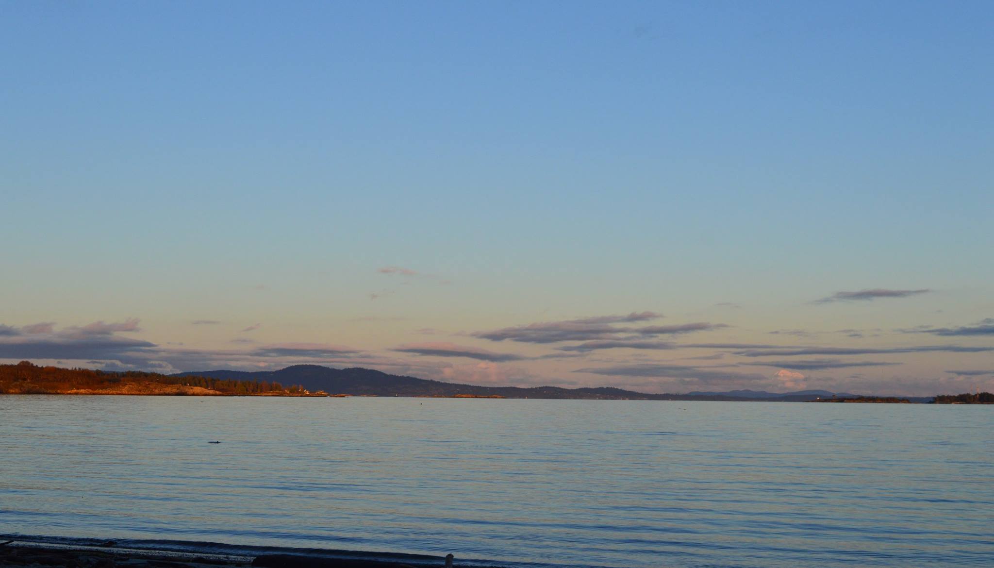
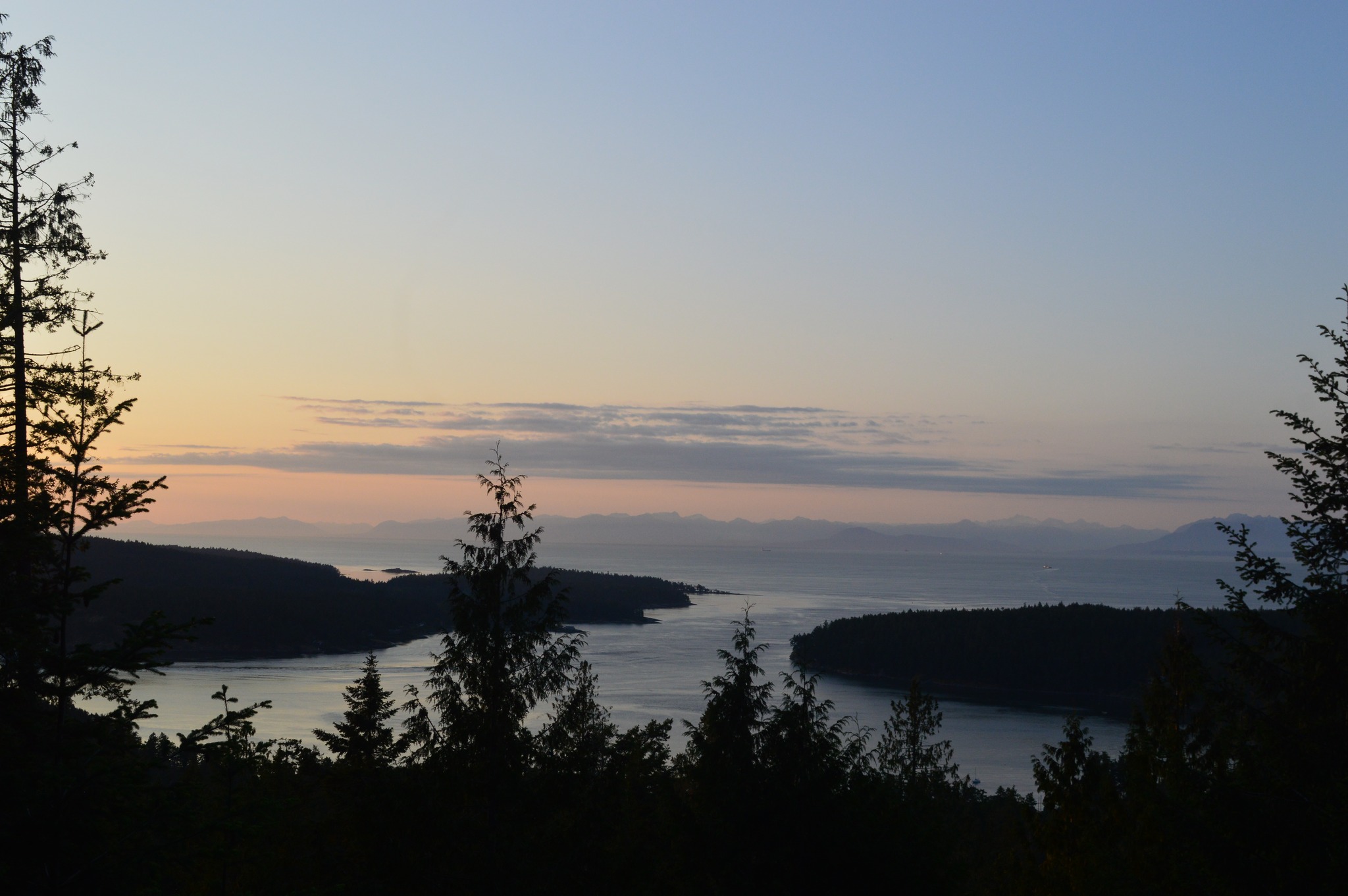
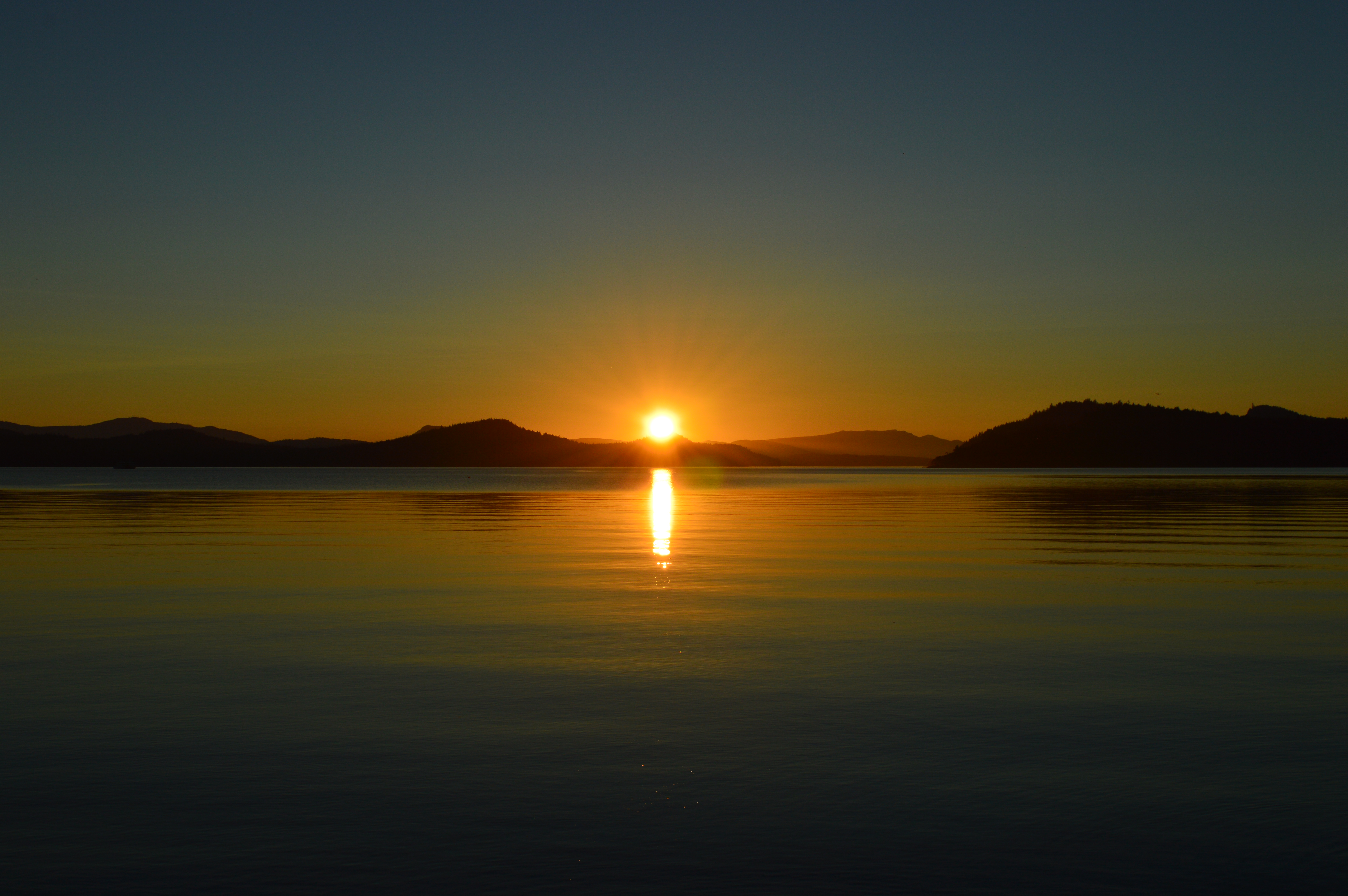
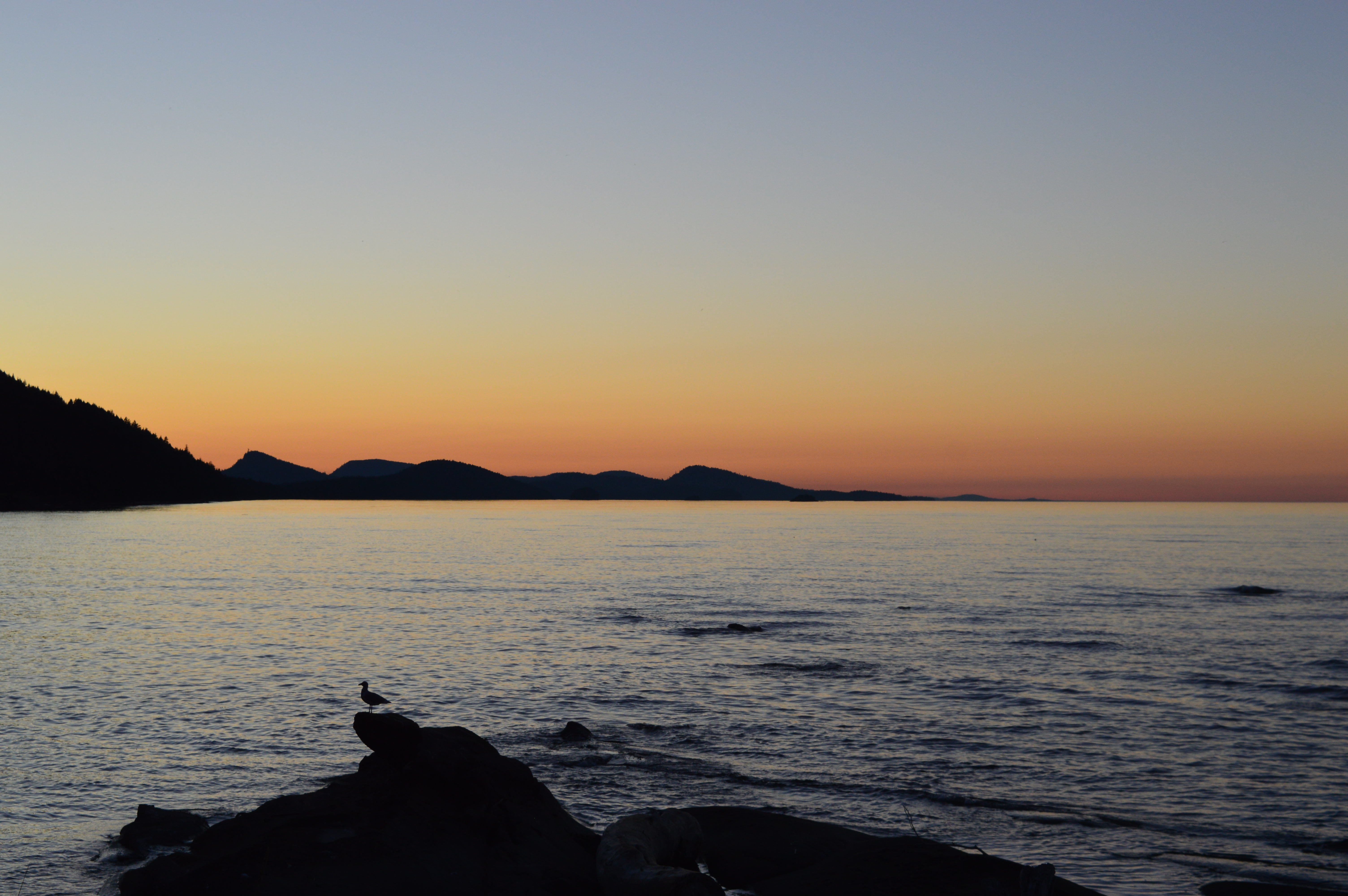
If you feel like returning here during your trip, Walbran Park is an excellent spot to watch a sunset!

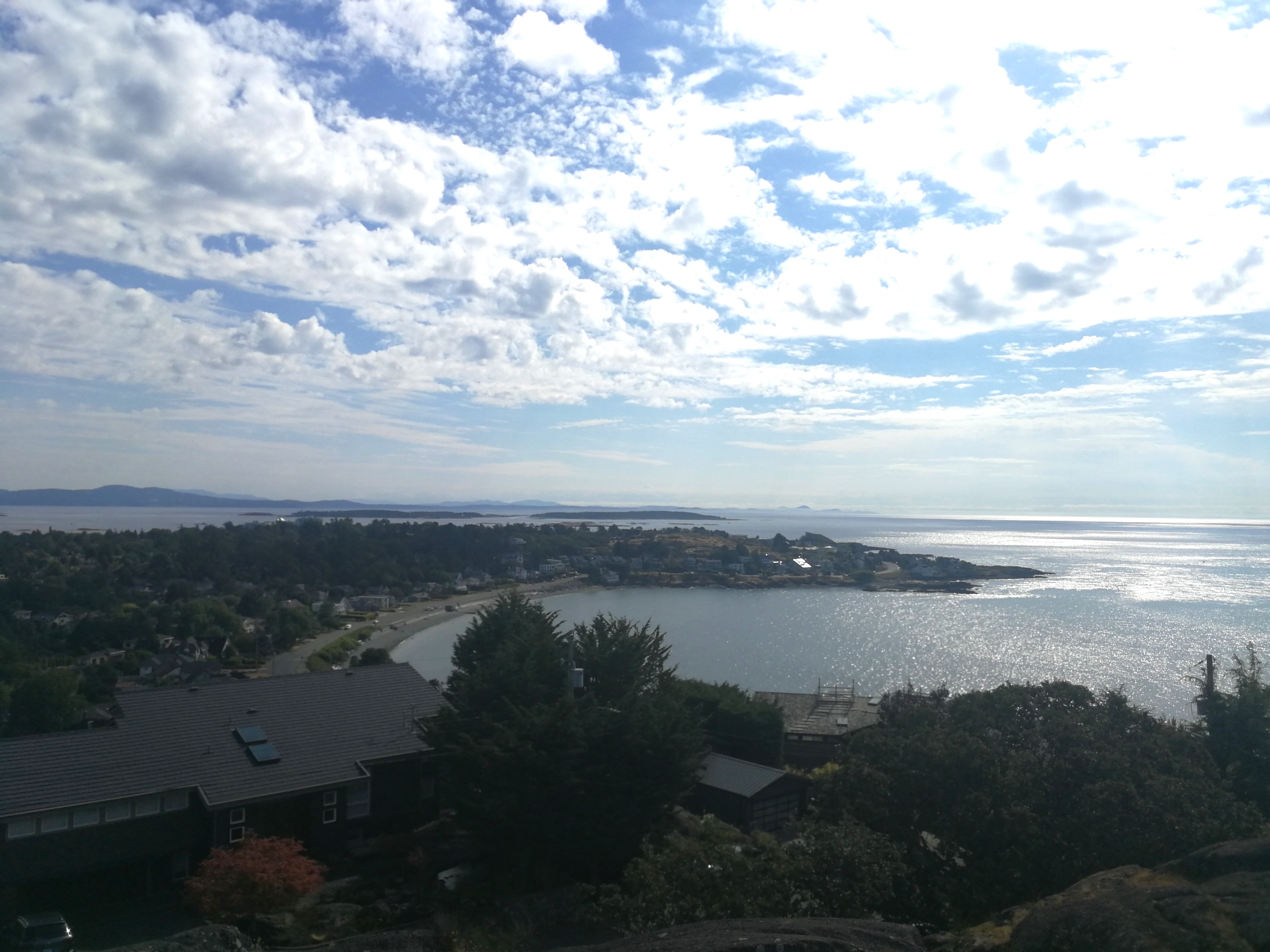
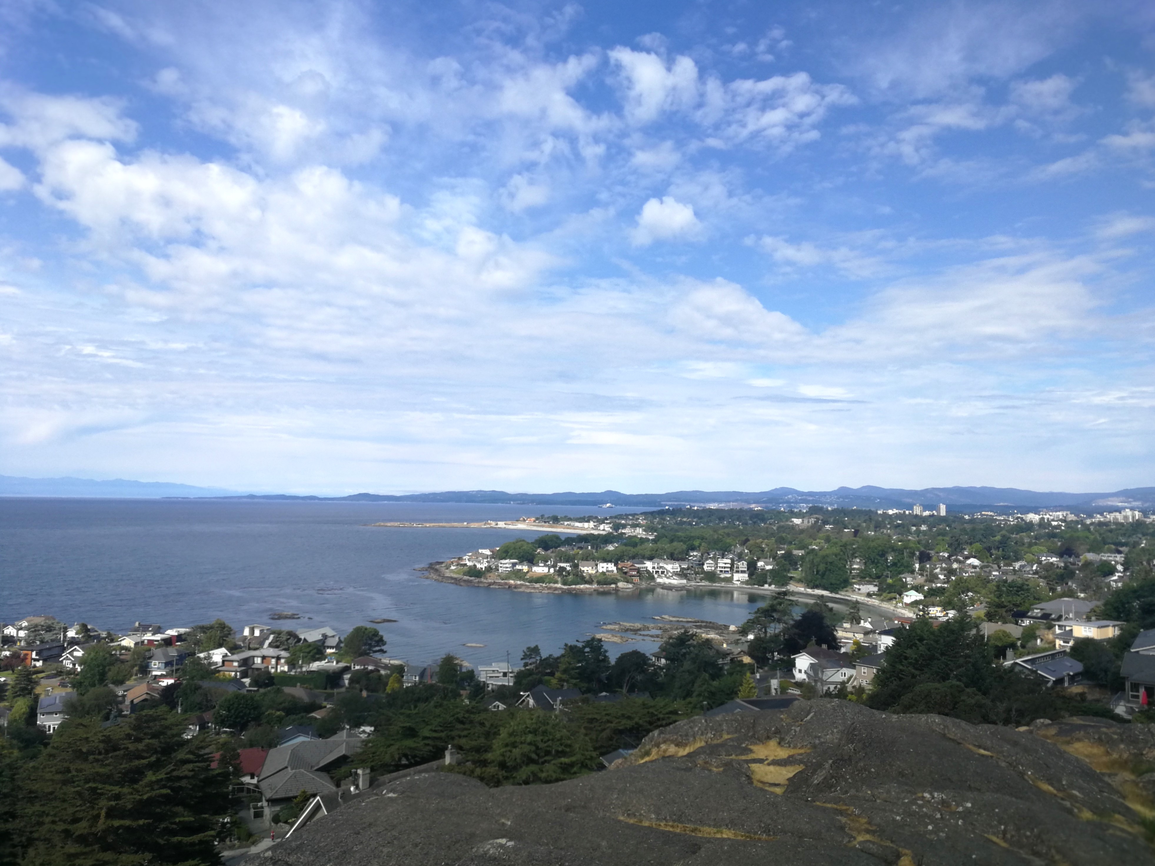
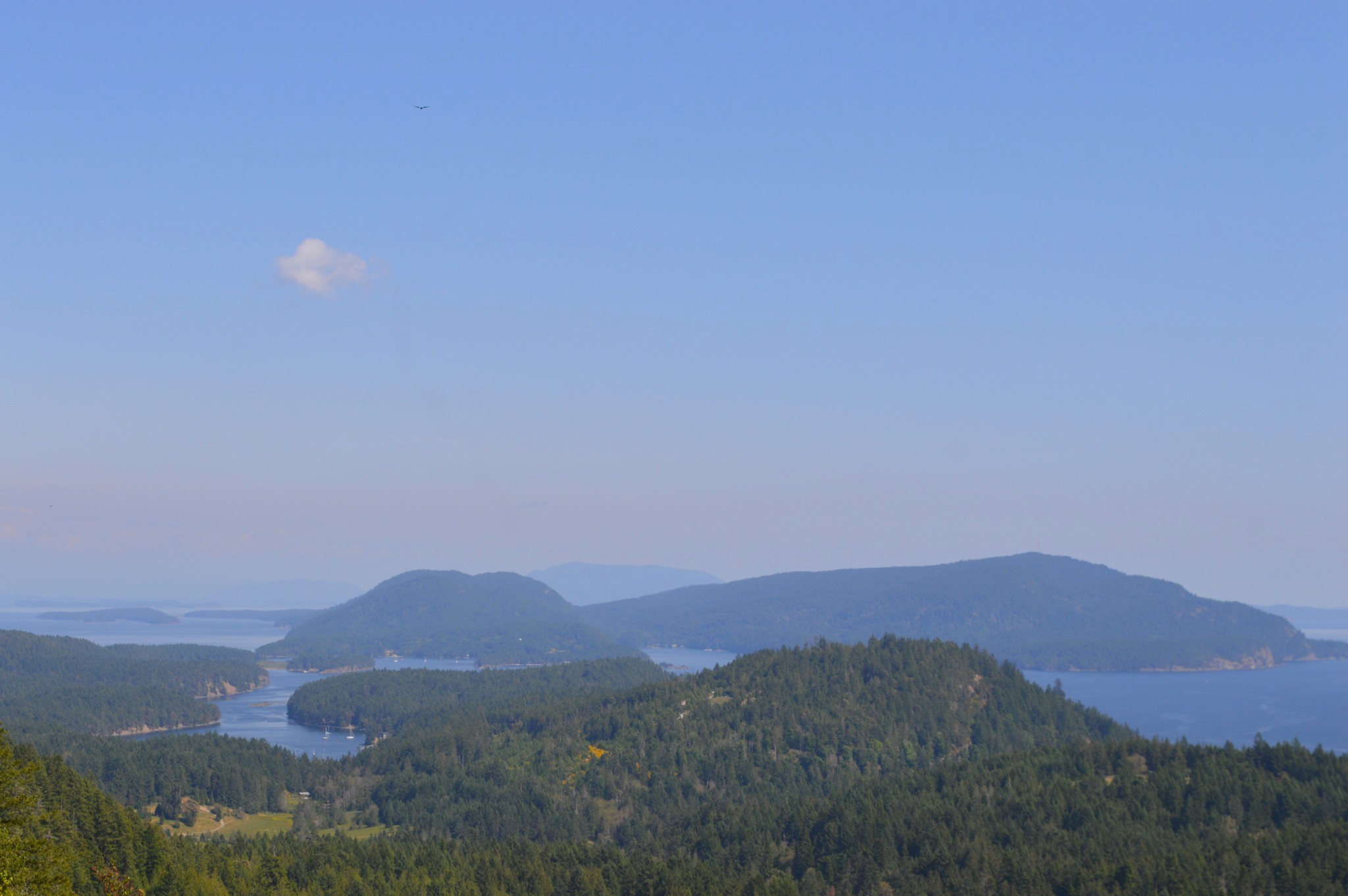
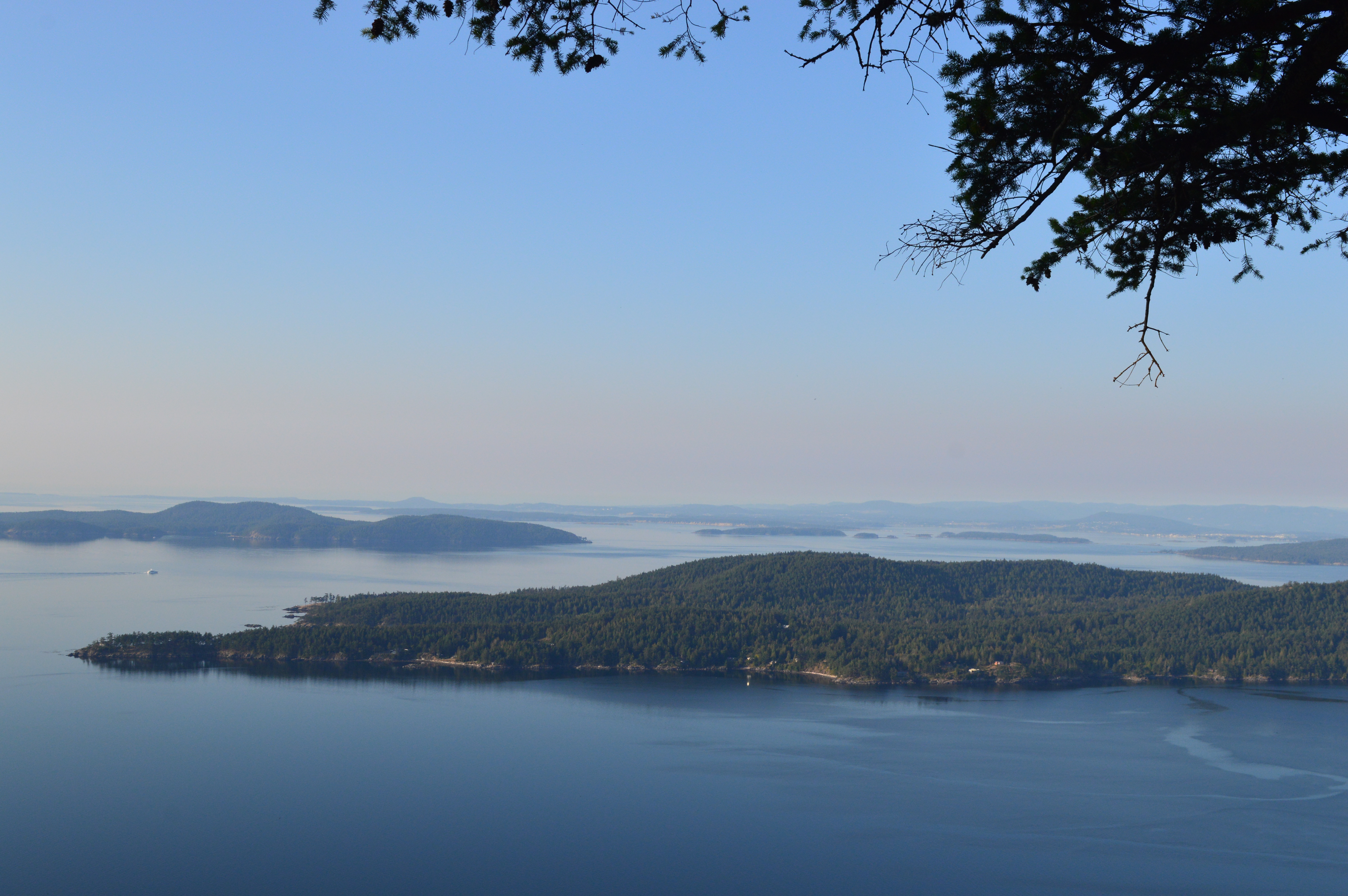
From this park, you can continue onto another nice viewpoint by walking left along Denison Road. After a few hundred metres, you’ll come to the entrance of Gonzales Hill Regional Park. Home to a striking white observatory, there are great views of glittering ocean, the leafy neighbourhoods of Fairfield and James Bay, the Westshore communities, and distant mountains of Sooke.

Views from Gonzales Hill

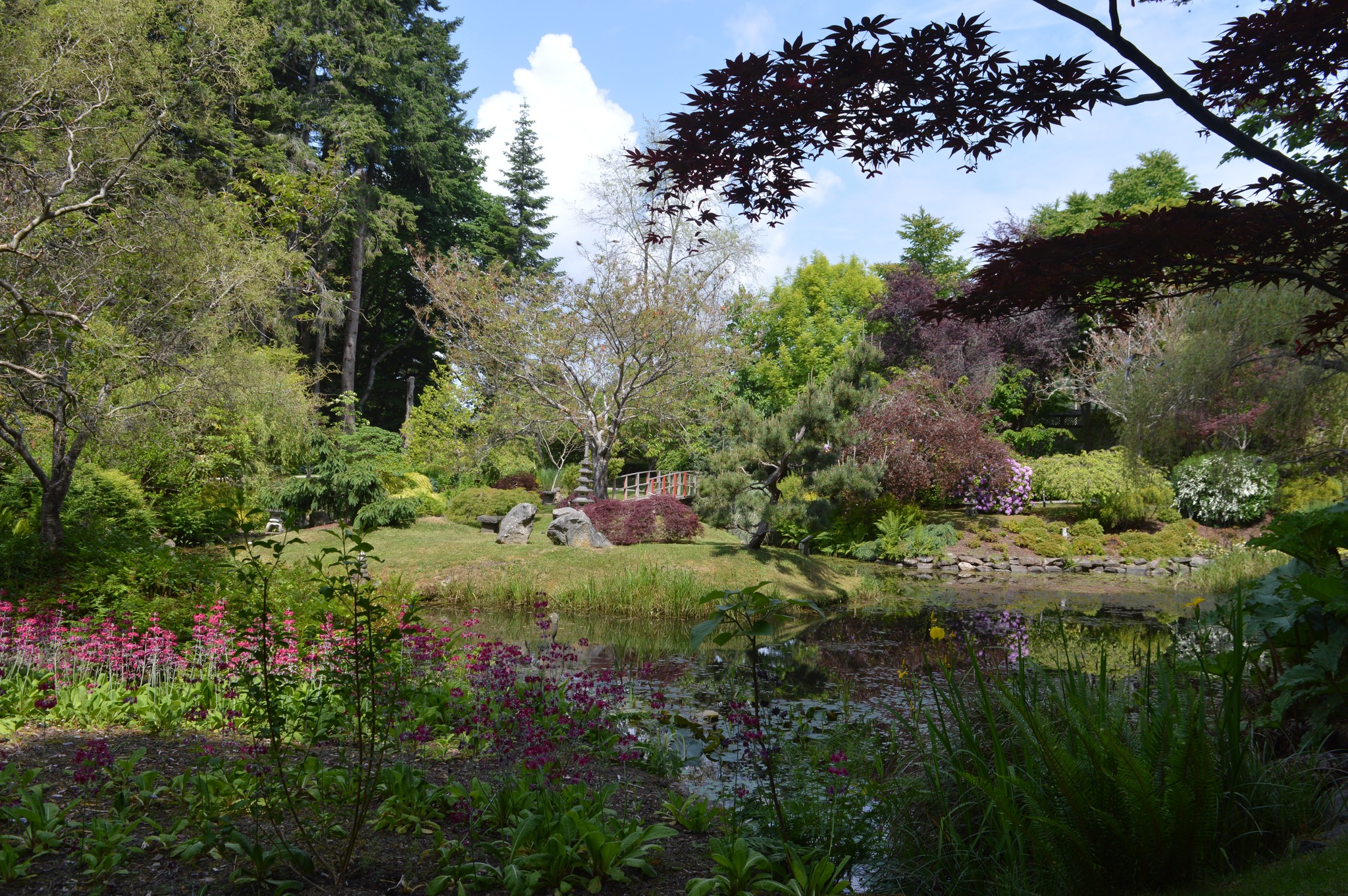
After all that walking, it’s time for a break and some cake! Exit Gonzales Hill via the path down Fairfield Place and, once on Fairfield Road, cross and walk down towards Foul Bay Road. On the right you’ll see an entrance to the Abhkazi Gardens, open everyday 11am-5pm with entry by donation. While they don’t have the same size and splendour as the world-renowned Butchart Gardens, these gardens are a lovely, tranquil place to wander through, without large crowds and the constant click of cameras. You might even see the small turtles by the pond!

The Teahouse within the gardens offers a few different menu options for high tea, provided in a cozy and non-pretentious setting. I had the afternoon tea last year and it was delicious! The final tea sitting is at 4pm. (Note that there is a dress code.)

Day 2:

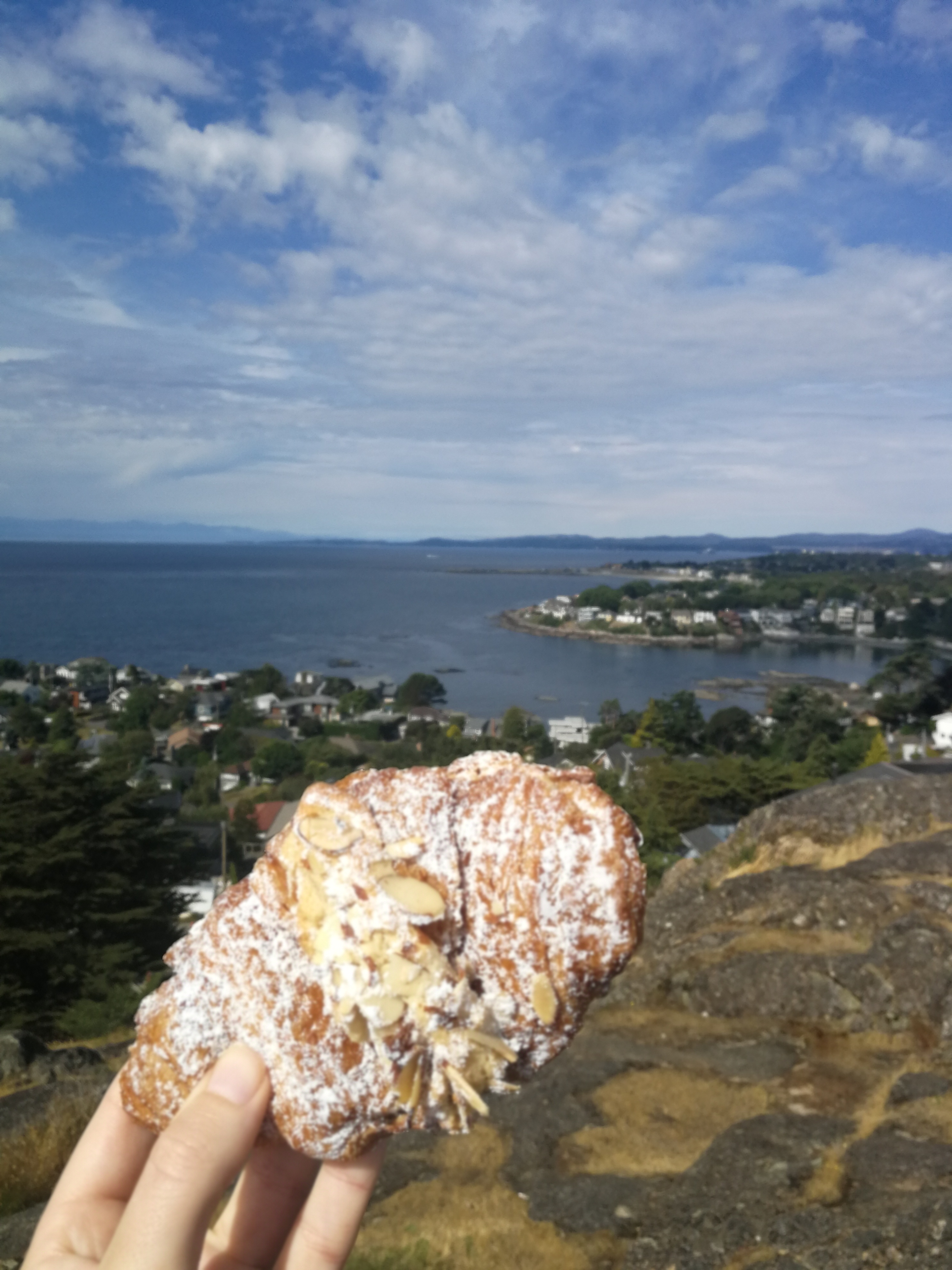
Start your day by stopping at Demitasse Cafe & Garden Centre on McNeill Ave. As well as selling plants, this sweet little cafe has yummy savoury and sweet pastries, including gluten-free options. The double-baked almond croissant is one of my favourites. Fun fact: if you read my book, this cafe is featured a few times in part 3!

From the cafe, walk south down Hampshire Road, turn left on Lafayette St, and then turn right down Monterey Ave. The road will lead you to Beach Drive with McNeill Bay in front of you. This wide pebble beach is popular with dog walkers, but not so popular for swimming due to the prevalance of seaweed and fairly choppy waves.

Walk along the esplanade before turning left up Transit Road. After a hundred metres or so, there’ll be a sign on the right indicating the Centennial Trail. Follow the narrow path that’s cloaked by trees and you’ll come to Anderson Hill Park. Looking over NcNeill Bay, it’s a good place to sit and eat your almond croissant!

Breakfast with a view!

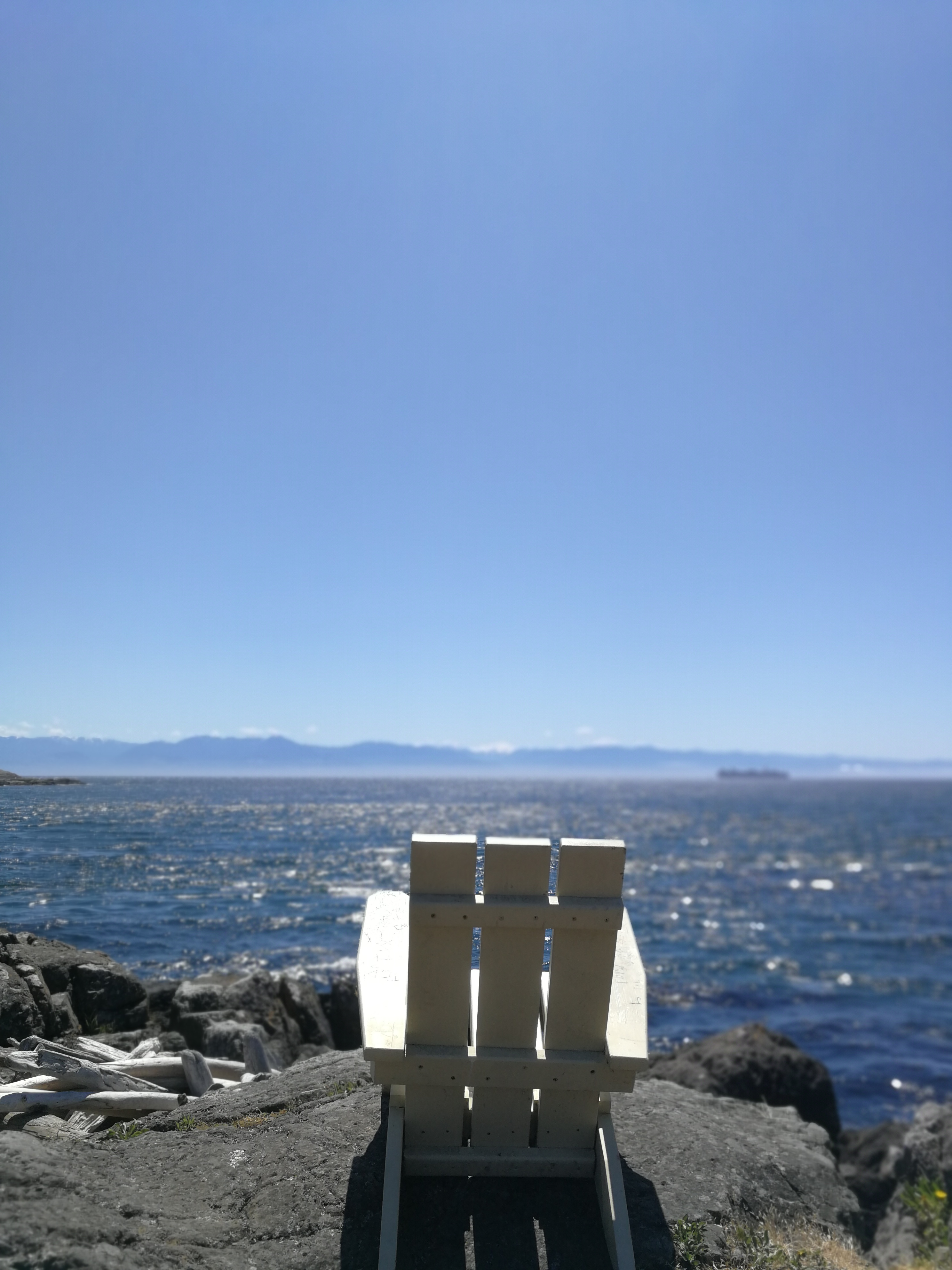
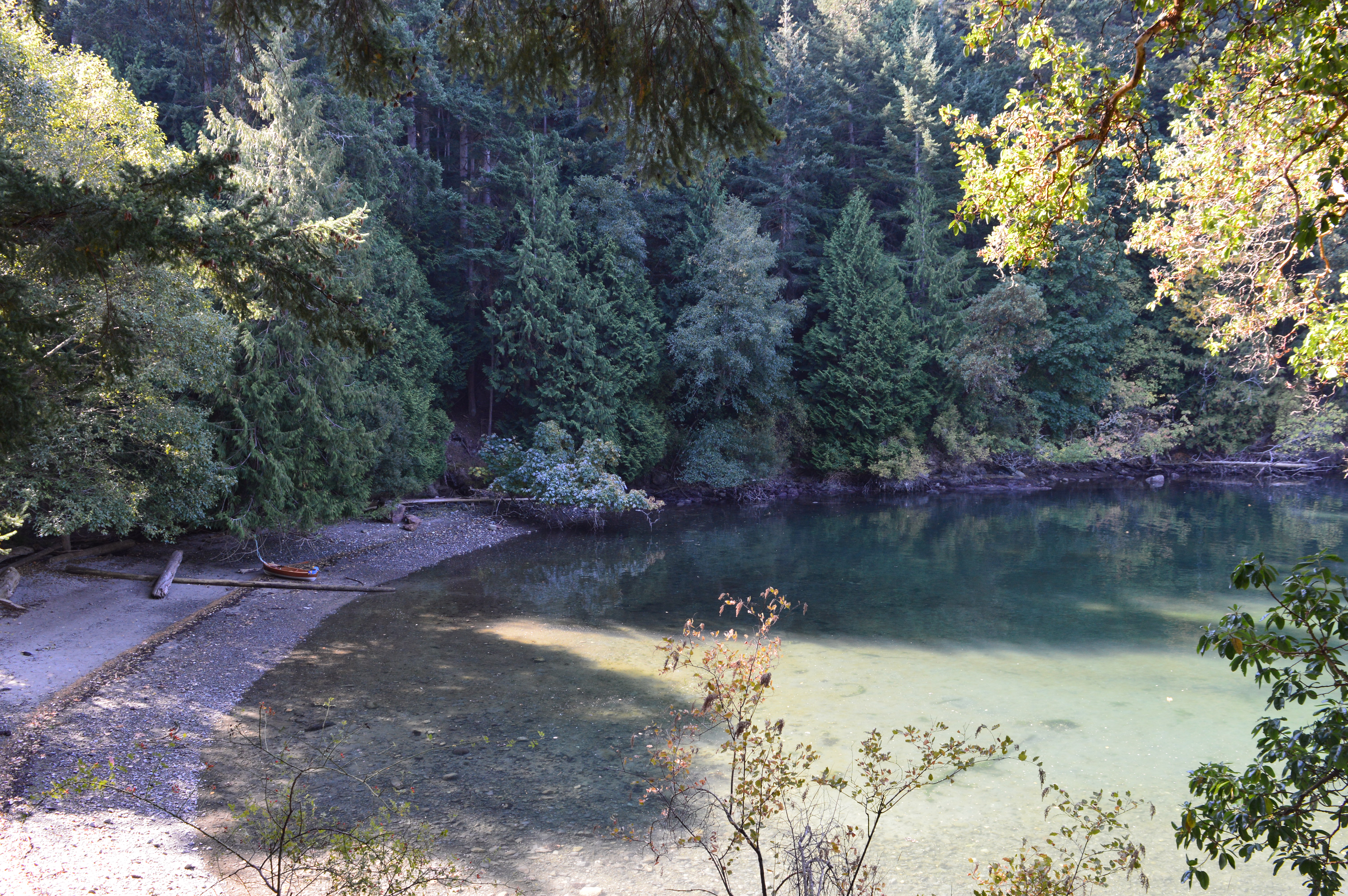
Go back the way you came down Transit Road until you return to Beach Drive. Cyclists will often pass by (some panting more than others!) as the road winds uphill to the right. At a rest area, you’ll see a small pebble beach below and some rocky bluffs with a few wooden chairs on top. This area is called Kitty Islet. Follow the path down and take a seat to enjoy a couple chapters of a book or watch the boats go by.

Views from Kitty Islet

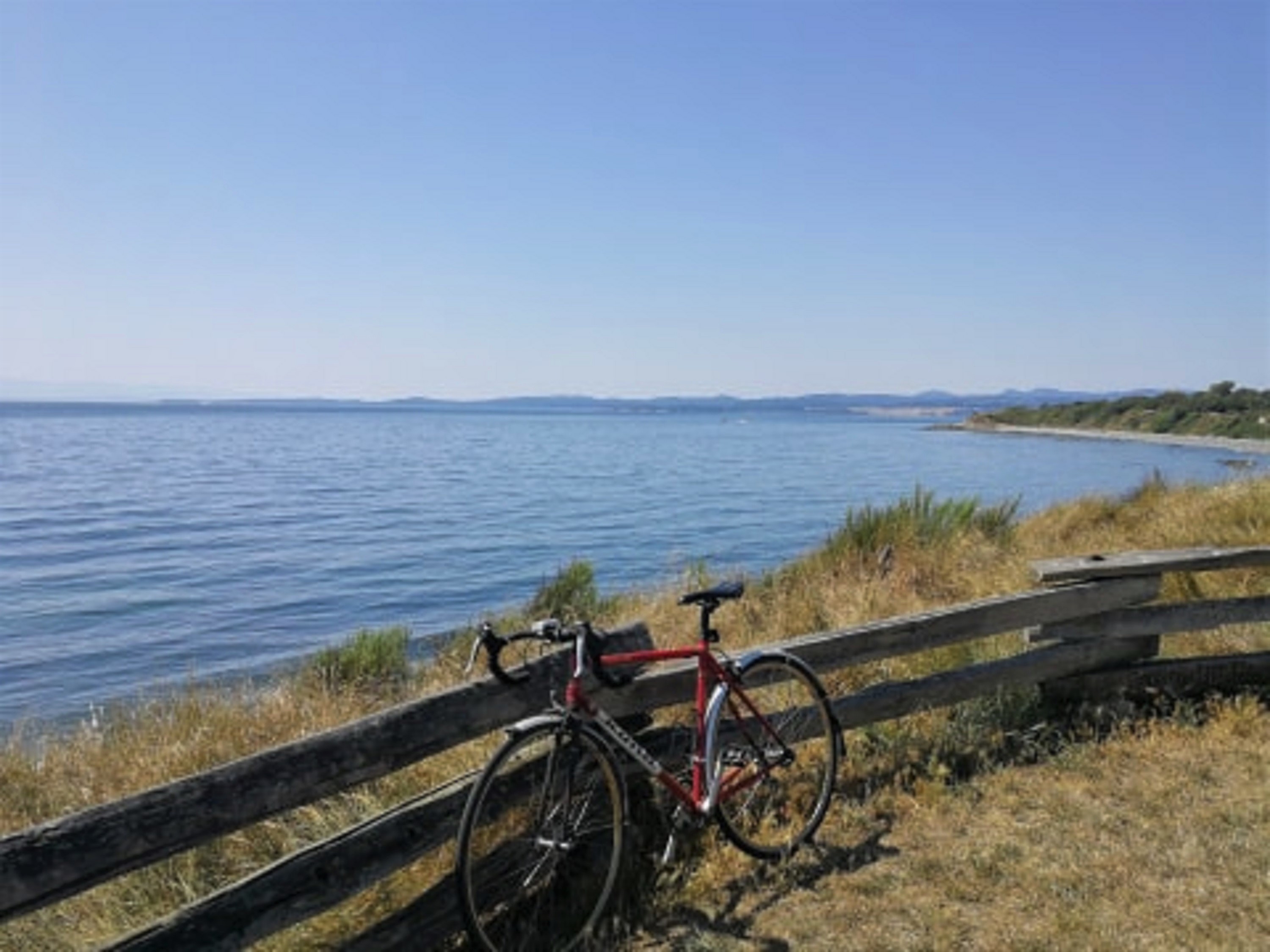
Once you’re ready to move again, continue along Beach Drive. Soon you’ll be surrounded by the neatly manicured lawns of Victoria Golf Club. Enjoy the ocean and mountain views as you walk – just keep an eye out for flying golf balls!

Beyond the golf course, you’ll eventually pass Oak Bay Beach Hotel, popular for it Boathouse Spa. A few years ago, some coworkers kindly gave me a gift card which I used to book a massage. At the time, guests received complimentary access to the sauna and mineral pools after their treatment. Now you have to pay an additional $30 to access them. If you have the cash to splash, I recommend booking yourself an appointment for a true self-care treat. Alternatively, you could stop for some lunch in the Hotel’s Faro restaurant, which specializes in Neopolitan-style pizzas.

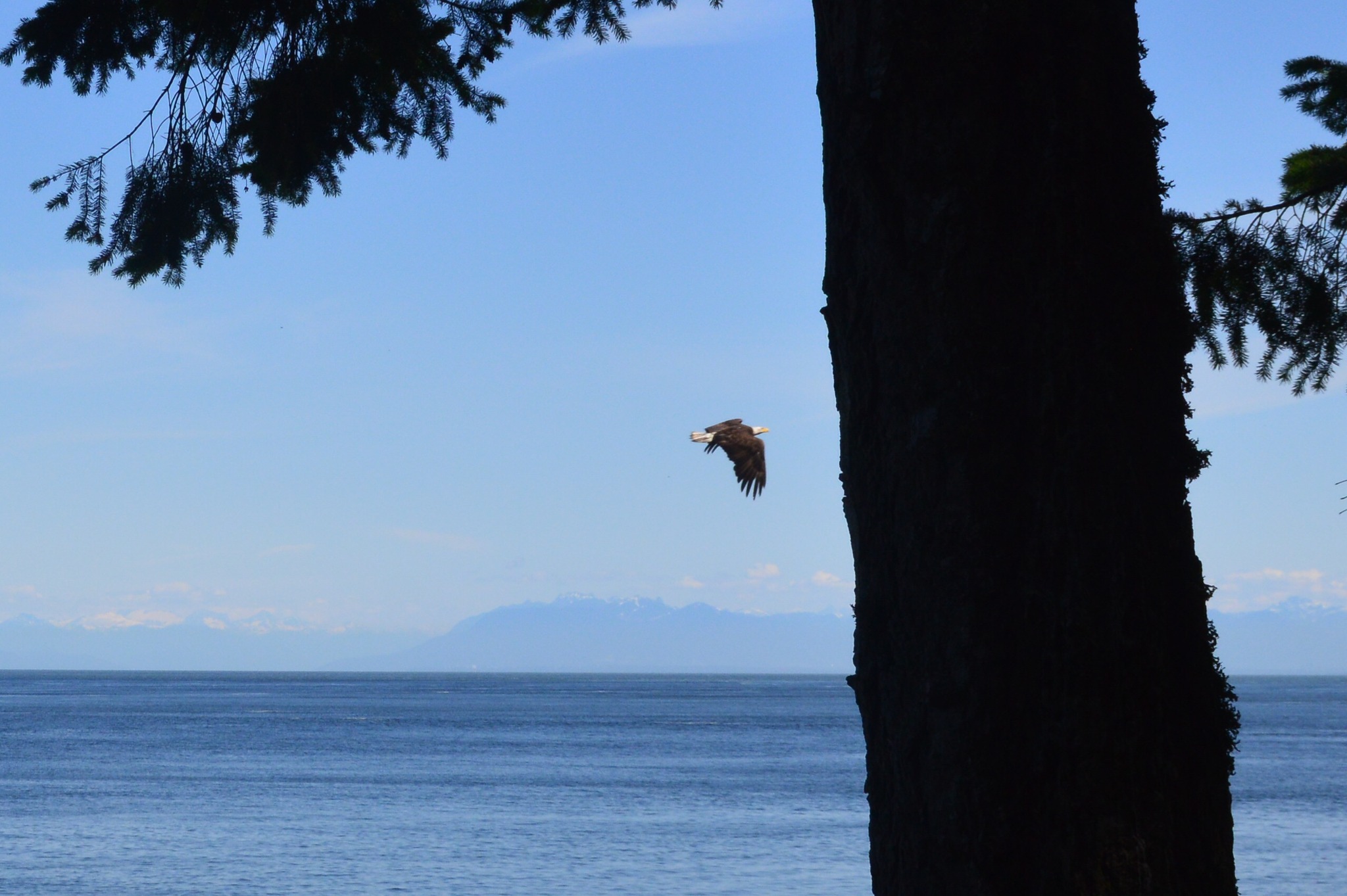
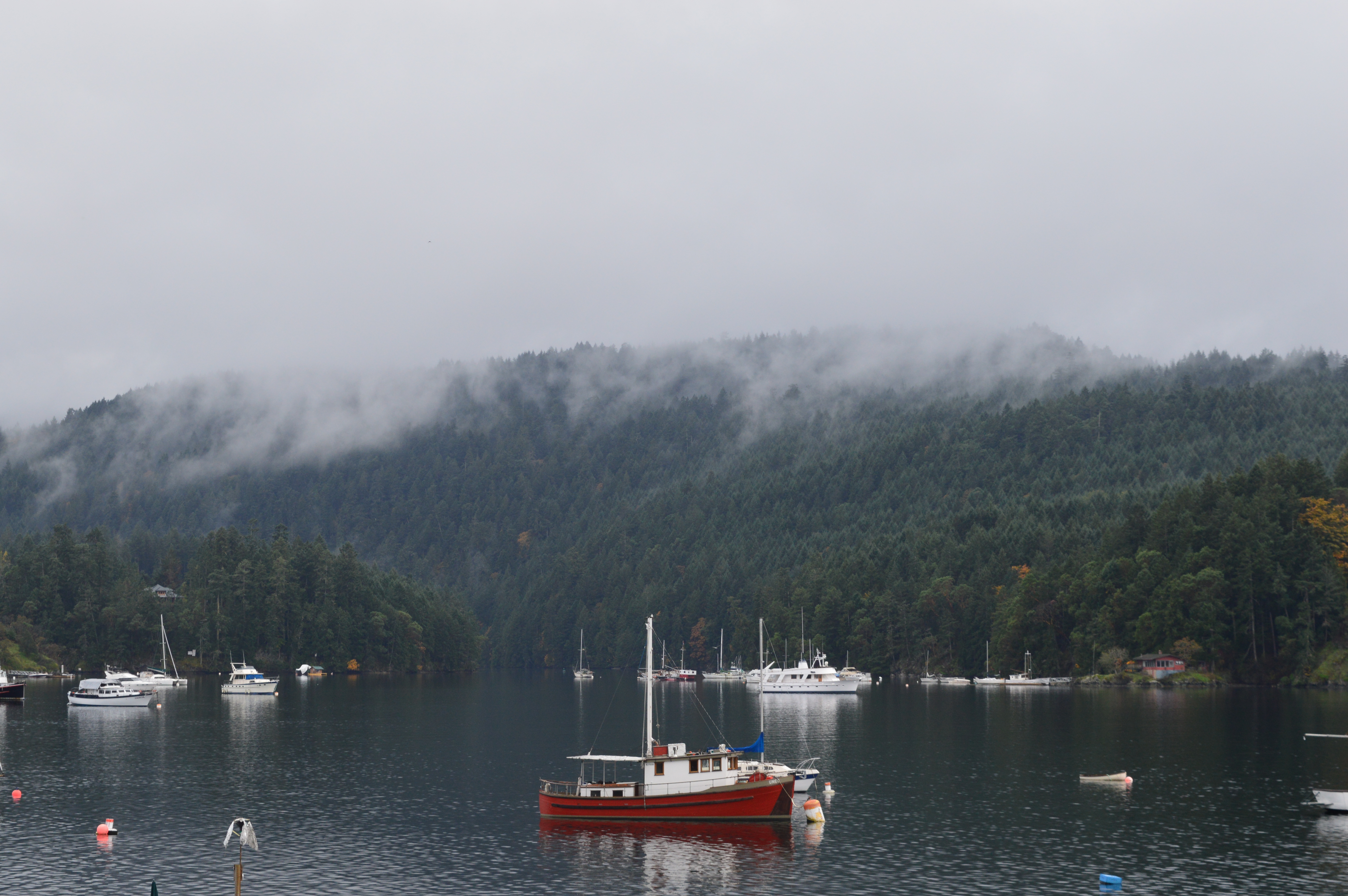
Continuing along Beach Drive, the interestingly named Turkey Head Walkway is by Oak Bay Marina. Seals can often be seen swimming by the shoreline. Around here, you can book a fishing charter or rent a kayak or canoe to explore the calm surrounding waters. A little further along is Queen’s Park – a pretty, grassy park good for picnics, reading, or just enjoying the view of boats bobbing up and down.

Queen’s Park

When you continue along Beach Drive, you’ll pass a shallow bay and then see Haynes Park on your right. Turn left up the crosswalk away from the park and follow the path that goes up some steps and joins Oak Bay Ave. This bustling main street has many businesses to keep you entertained – a chocolate shop, florist, garden centre, art shop, bike shop, and fashion boutique to name a few. You’ll often see retired locals sitting with their dogs outside a coffee shop, chatting away. Popular dinner options include the Penny Farthing Pub, Vis-a-Vis, Bon Sushi, Deadbeetz Burgers, and Tapas on Oak.

On the second Wednesday during the summer months, the Avenue comes alive with Oak Bay Night Market. Live musicians play as local vendors sell crafts, jewellery, art, jams, honey, cheese, and more. A barbecue sizzles and food trucks sells various dishes, from Greek wraps to poutine to curries.

Day 3:

Grab a beverage and breakfast item to-go from Pure Vanilla Bakery on Cadboro Bay Road, or alternatively, sit down for a meal at The Village restaurant on Estevan Ave. I haven’t eaten at The Village myself, but everyone I know that’s eaten here has said good things.

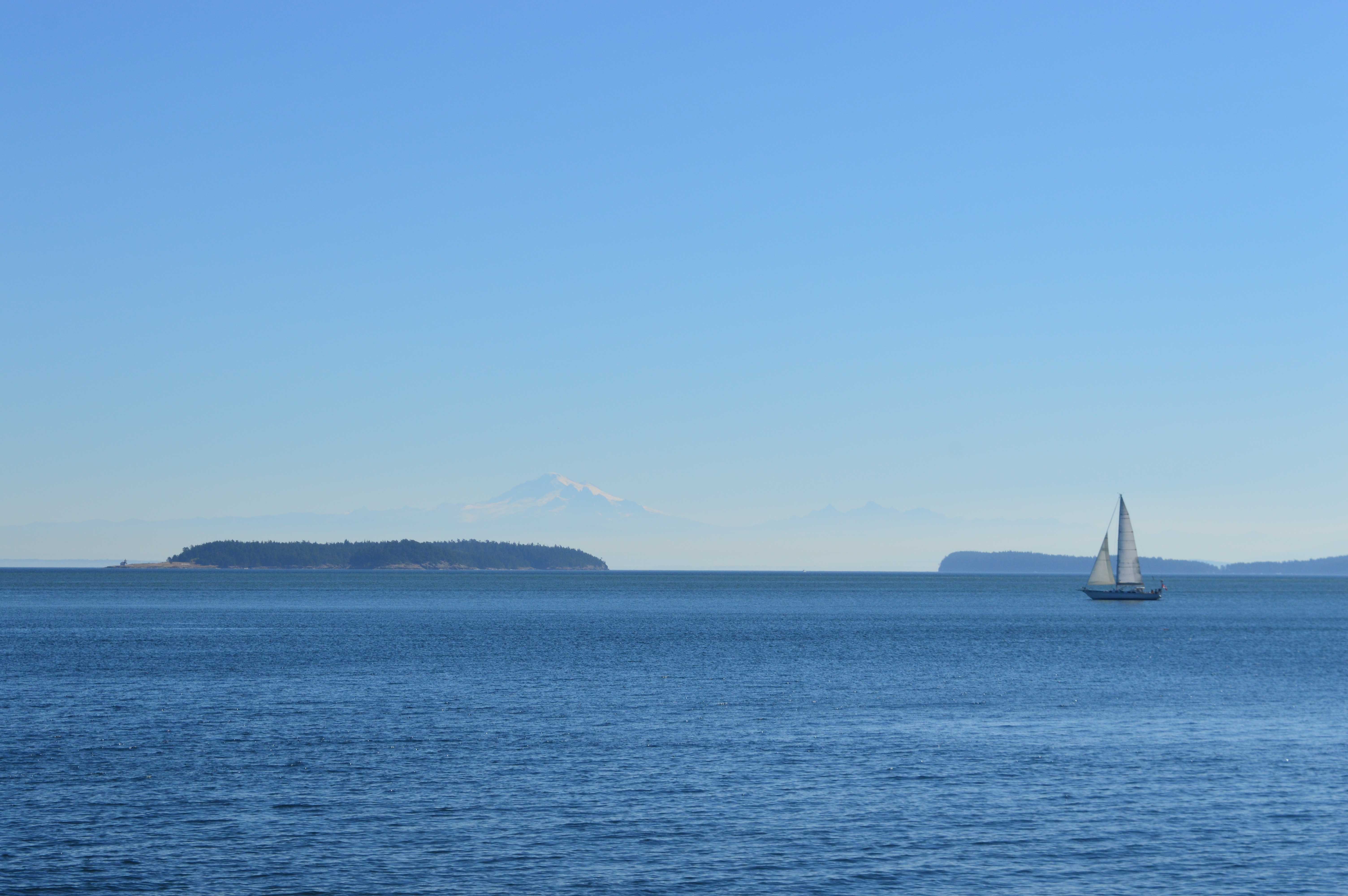
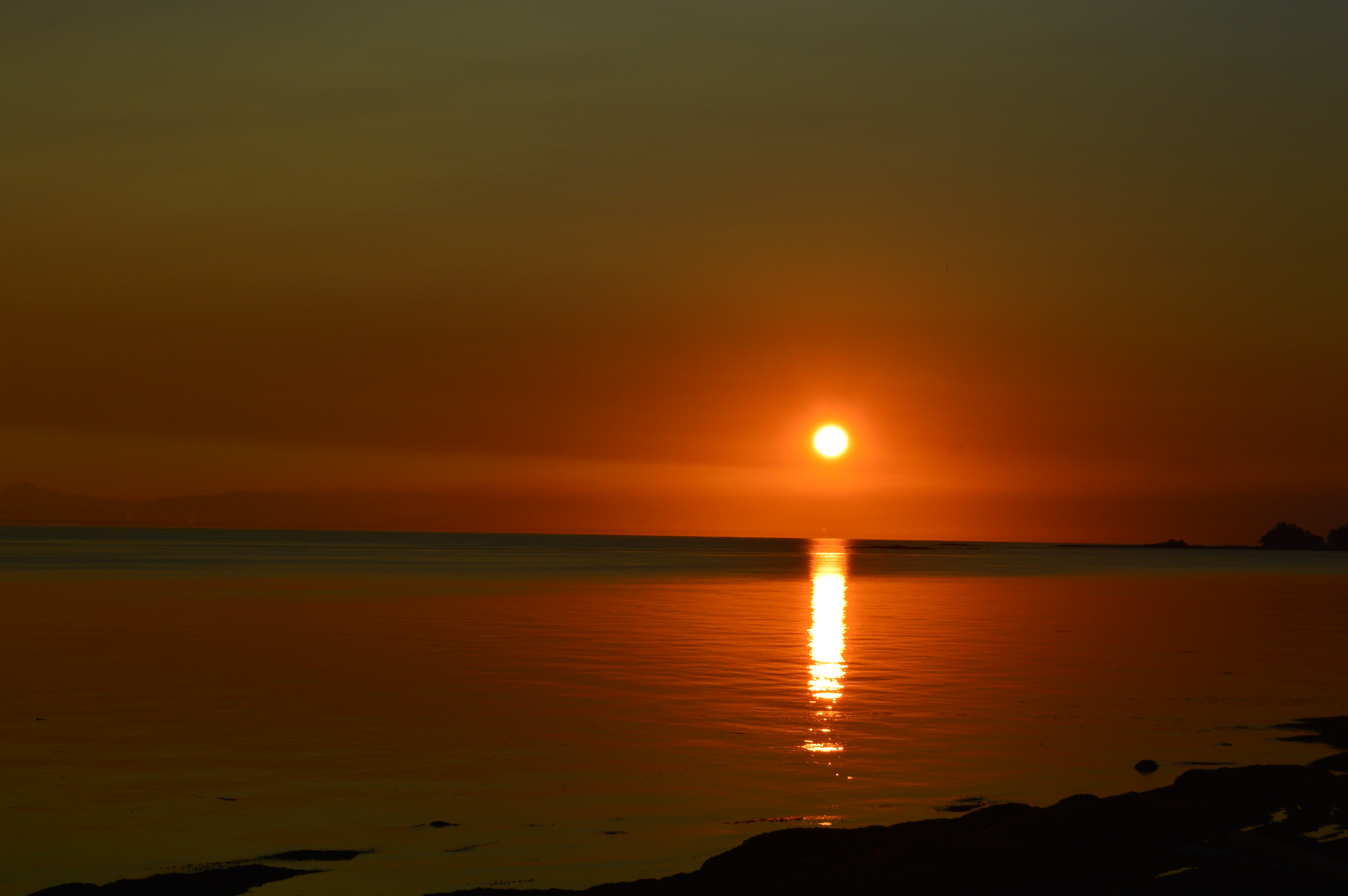
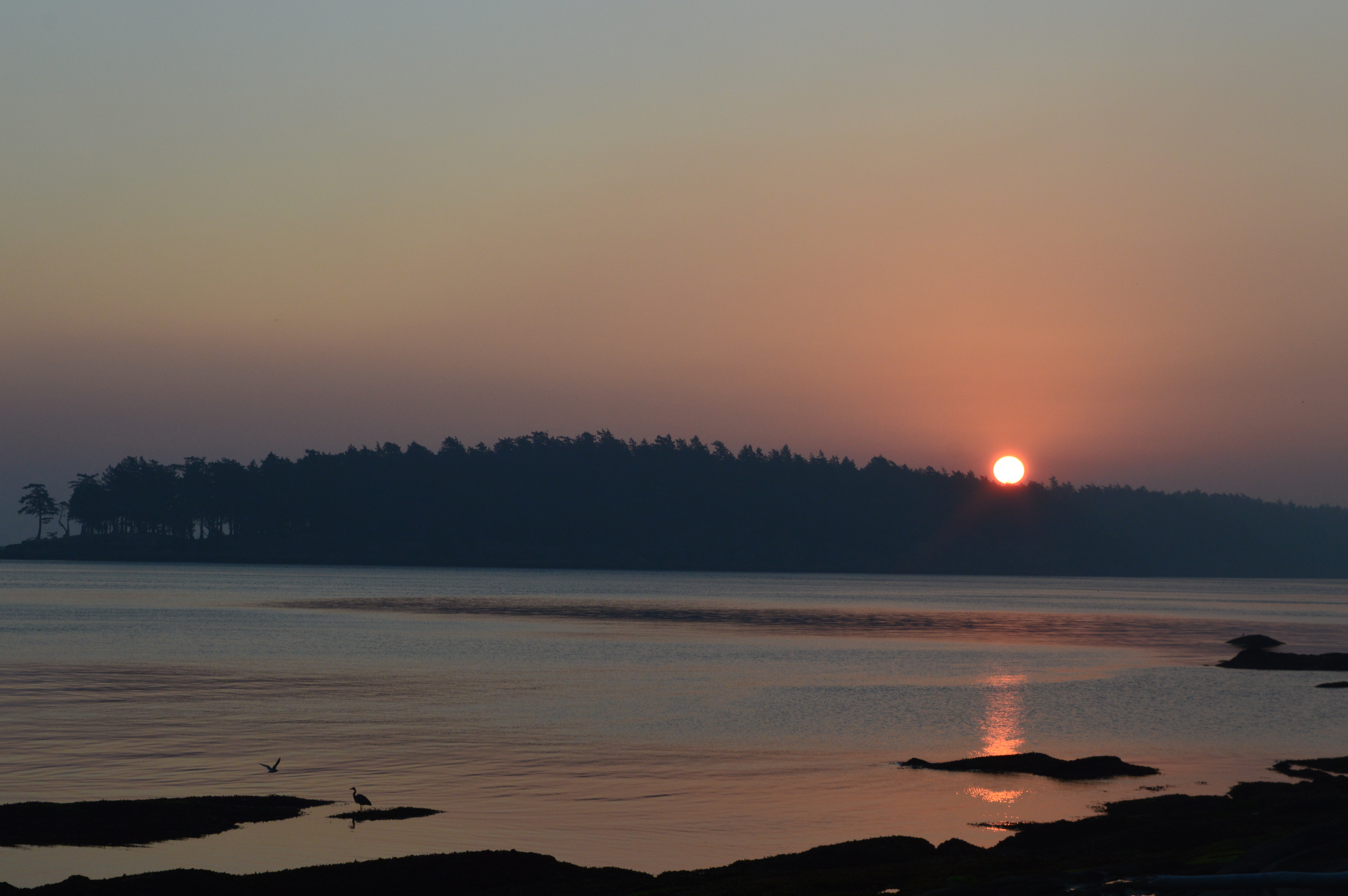
Continue down Estevan Ave and the sight of sparkling water will come into view. This is Willows Beach, one of Victoria’s most popular places for sunbathing, picnics, paddleboarding, and an ocean dip. Runners will often jog along the esplanade and on an evening, seals might pop their heads up out of the water curiously. On a clear day, Washington’s Olympic Mountains rise up formidably in the distant west. The beach area also has a playground and public washrooms. Dogs are not permitted on Willows Beach between May 1st and September 30th. If you visit outside of this season, you can enjoy the sight of dogs galloping gleefully along the sand, making furry friends.

After catching some rays and having a splash, wander east along the espalanade and walk up the stairs. Following the path to the right takes you to Cattle Point. Where does this name come from, I hear you ask. Well, during the late 19th Century and early 20th Century, this area was the destination for unloading cows from steamships, and the cows would swim a short distance to shore (a funny image to picture, I know!) No cows are unloaded today and instead there is a boat launch. The east side of Cattle Point looks out towards Cadboro Bay, the next neighbourhood along. On a clear day, you’ll get a striking view of Mt. Baker in Washington State.

Willows Beach and Cattle Point are pretty places to visit during the evening, with the sky turning a soft lilac as the sun goes down. They are regularly featured in my book!

Evening view from Willows Beach

Cattle Point is part of Uplands Park. If you follow the loop round until you rejoin Beach Drive, across the road you’ll find an entrance to the main section of the park. It’s a peaceful oasis with various flat trails through Garry Oak meadow. Whenever I come here, I think it would be a great location for an engagement shoot or wedding photos.

For lunch, walk back along Beach Drive with its million-dollar houses and turn right back up Estevan Ave. Willows Galley is a family-run fish and chip shop open 12pm-6pm except Mondays and Tuesdays. As someone who comes from the country of fish and chips, I can confidently say I approve! The menu also includes burgers, poutine, and ice cream. Just up the road past Musgrave St is Lokier Garden, a quiet setting in which to enjoy your meal.

Within Estevan Village there is a florist, jewellers, barber shop, women’s gym, and clothing consignment store. You’re bound to see customers outside the popular Ruth and Dean bakery and cake shop, and near here is Bungalow gift shop which sells a variety of items including home decor, stuffed toys, soaps, and cards.

When it comes to dinner plans, Nohra Thai Kitchen on Estevan Ave has excellent reviews, as does the nearby Taiwanese restaurant AsUsual Cafe. Another option is the fancy farm-to-table restaurant Sedona, on Cadboro Bay Rod. Otherwise, The Old Farm Market on this road has a good selection of local products if you’d like to make your own dinner.

*

If you’re planning a trip to Victoria, I hope you’ll give yourself a few days to explore some of the neighbourhoods outside of the downtown core. I’ve lived in or around Oak Bay for most of the years I’ve lived in Canada, and the places I’ve mentioned in this post never lose their charm. If you like going for walks and finding scenic views, you’ll love exploring these areas!

GPSMyCity is an app that adds GPS coordinates to blog posts so you can access your favourite travel guides from your iOS or Android device, with a map included to help you navigate your way around. If you have a trip to Oak Bay planned and would like to reference this article, follow this link to download : https://www.gpsmycity.com/gps-tour-guides/victoria-4511.html

Me Time on Mayne Island

For my birthday this year, I decided to give myself the gift of alone time and plan a short trip somewhere. I opted for Mayne Island, one of the Southern Gulf Islands a 55-minute ferry ride away from Swartz Bay on Vancouver Island. One of the smaller of the Gulf Islands, Mayne’s Indigenous name is SḴŦAḴ in SENĆOŦEN, the language of the W̱SÁNEĆ people who are part of the Coast Salish Nation.

My idea of “me time” involves being outside exploring woods, strolling along beaches, and hiking up mountains before a quiet, relaxing evening of watching the sun go down. Read on for my observations of places I explored while on Mayne Island!

If you do a simple Google search for trails on Mayne Island, you won’t see many options appear. During the journey with BC Ferries, be sure to grab a map as this will highlight the various trails that are available.

After driving out of Village Bay ferry terminal, I took a right down Dalton Rd and headed towards Dinner Bay Park, which is home to the Japanese Garden. A little oasis, the garden was beautifully serene. It was created to honour the large community of Japanese people that lived on the Island between 1900 and 1942, before they were interned as a result of the Pacific War. Entrance is free but there is a donation box. I dropped in a $5 bill which was the only cash on me and a small gesture of appreciation for the volunteers who do a great job maintaining this gem.

From Dinner Bay Rd, I drove down Mariners Way, turned right onto Marine Drive, then joined the narrow Navy Channel Rd. I parked off road and walked down to the beach that is known as Conconi Reef Community Park. The ferry from Saturna Island will pass through Navy Channel en route to collect passengers from Mayne. As I walked back up from the beach, a starling on the path tottered ahead, only to stop and look back at me, hop a few more paces, then stop again. It did this for a minute or so, as if showing me the way to go.

Something I really liked about Mayne was the limited signage. I realize this might seem like an odd thing to like. Indeed, when I’d looked on Google Maps for ideas of where to go, some people had written reviews complaining about the lack of signage. To me this is a sad reflection of a modern society in which people want things instantly and with zero inconvenience. It’s as if humans have reached such a point of anxiety that they’re afraid to get lost or make mistakes, and don’t know how to be resourceful. Maybe it’s childhood memories of my parents turning the car round while road tripping through a foreign country, but I enjoy the process of trial and error. It feels more adventurous. And hey, it’s made me great at 3-point turns!

I parked my car off Simpson Rd and walked up Punch’s Alley – a pathway flanked by large meadows – into Henderson Park. The striking turqouise-blue shell of a cracked starling egg near the entrance of another pathway signalled the start of the Doreen McLeod trail, which takes you on a tranquil walk through lush vegetation down to a pebble beach overlooking Navy Channel.

By the time I returned to my car, it was two o’clock and I was feeling peckish. I drove up Gallagher Bay Rd, passing dogwalkers that would wave, and turned left onto Fernhill Rd, passing a bookstore and farmstore on the left and an elementary school on the right where children played ball games. There’s a little village in Miners Bay with a library, bakery, restaurant, grocers, and a community park. Sunny Mayne Bakery has housemade sandwiches and baked goods.

As I sat eating, a car honked loudly from outside. The group of locals that were sat on the patio enjoying afternoon coffee and cake looked over in its direction with surprise. The aggressive noise seemed so out of place in this quaint little hub. The driver of the vehicle was trying to get the attention of the passenger that had gotten out. There was no doubt they were a tourist. What was that I said about people wanting things instantly with no inconvenience..?

Not wanting to contradict myself on the topic of convenience, but the reality is that we all need to access WiFi sometimes. Cross the road to the public library and you should be able to get signal from the outside porch. (Because I hate being that person who goes inside a place and says “I’m just looking to use your WiFi.”) For groceries, Tru Value Foods has a pretty large selection of foods, including a deli section. The Trading Post on Fernhill Rd has a fairly limited selection of food but is the place to go for alcohol. I proactively handed the cashier my ID, and she said in a cheery voice that she wasn’t even going to ask me. Is this what happens when you turn 31?

My accommodation was an airbnb right inside Mt. Parke, accessed via a private track road. The views from the balcony and living room of Raven’s Nest cottage were gorgeous – a peaceful place to sit and watch eagles and turkey vultures gliding through the sky. The hosts provided lots of amenities (including binoculars) and put a lot of thought into little details.

One of the things I wanted to see most on Mayne Island was the view from the top of Mt. Parke. I joined the track that continued from the airbnb and turned right up a narrow trail. (If you take the trail on the left, you join a network of trails within Plumper Pass Community Park.) At the ridge, the views were similar to those seen from Mt. Warburton Pike on Saturna Island, but no less impressive or exciting. A dazzling vista of lush green islands, sparkling blue ocean, and distant mountains. At the cliff edge, I looked down to see a blanket of Douglas, Fir and Red Cedar trees below. This would have been a bad time to turn around and see a cougar or bear. Thankfully, there are none of those on the Island!

*Maps indicate that the trail to the summit can be accessed from Kim Rd or Mt. Parke Rd. The latter is technically a private road that I was only allowed to take because I was an airbnb guest within the park. Expect to be asked to leave if you’re not a guest and you’ve parked before the emergency gate.

Satisfied with the day’s activities, I returned to my airbnb and spent the evening looking out at the view, watching the hourly ferry sailing through Active Pass to and from the mainland. The white-capped North Shore mountains behind Vancouver were visible in the distance as the sky softened into a palette of lilac and pink. I spent a lot of time peering through the binoculars in hopes of seeing a whale, but no luck this time.

After a peaceful sleep in a comfy bed, I woke early the next morning, ready for an active day. Hummingbirds zoomed past the kitchen window and hovered at the feeder. First, I drove to Horton Bay Rd and took a right on Beechwood Drive to access the other side of Henderson Park. There’s a small parking lot at the end of a short gravel track. The Vulture Ridge Viewpoint Trail up Henderson Hill was a fun, moderately steep hike about 1km long. Along the way, a couple of deer looked up timidly from behind the trees before trotting off gracefully.

The viewpoint looked out at the Navy Channel sea passage in front of North Pender Island. Bald eagles and turkey vultures soared overhead. An informational board explained that turkey vultures will vomit their food if a predator or human comes across them eating their prey. This is so they can fly off to safety with as little weight hindering them as possible. They also pee on their own legs to help stay cool. (I found this interesting but I apologize if you were eating while reading that..!)

Due to its location, this would probably be a great place to watch the sunset. After spending several minutes admiring the view, I came back down via the East Boundary Trail.

Next, I drove back to Horton Bay Rd and turned right to go down to St. John Point Regional Park. This was a place that had received some negative reviews on Google for being “hard to find.” Either those people are blind or things have been updated, because there was a sign referencing the park’s name. A small parking lot can be found at the end of a short gravel track.

I followed a grassy path down to Kadonaga Bay and then joined a trail into the woods. As I crouched down to retie my shoelace, a dog that looked like a mix of a Poodle and Border Collie bounded up from behind and jumped on me excitedly before running off again. Things became a little calmer in the forest, which was filled with the peaceful sound of birdsong. Decorated with Arbutus trees, the trail along coastal bluffs overlooking Plumper Sound was lovely. I imagine this would be a great place to spot whales and other sea life, but none of them fancied making an appearance today.

As I rejoined the grassy path, the dog reappeared, tail wagging madly and tongue shaking saliva. I spent a couple of minutes giving him belly and head scratches before asking “Where’s home?” Upon hearing the H word, he galloped off suddenly without a goodbye. And that was that.

Next on my itinerary was a visit to Campbell Point on the north east of the island. Off Wilkes Rd there’s a shaded parking lot in front of Bennett Bay Beach. Along the Campbell Point Trail I greeted a few friendly locals walking their dogs. Part of the Gulf Island National Park Reserve, the tip of the park looks out over Georgia Strait and towards Saturna Island. I’d recommend coming here for sunrise as I imagine the view would be wonderful.

I followed a trail back along the bay, passing a heron perched on a rock down below the cliff. The beach was sandy, but overall it wasn’t as amazing as I’d expected it to be from my reading. I don’t know if it was because the tide was out or there was a boat launch jutting out that affected the view, but this beach just didn’t do it for me for some reason. That said, I’m sure there are many that would love it.

I was curious to explore Mt. Parke from the actual public trailhead. Afterall, it’s not just about the view at the top, but the journey to get there! So I headed inland and parked at the end of Kim Rd off Felix Jack Rd. The Mary Jeffery Nature Appreciation Park Lowland Nature Trail is a loop trail. I took the southern side of the trail, from where you can turn off briefly to view the aptly named Giant Arbutus Tree. I then took a right and joined the Halliday Ridge trail which takes you on a lovely route through the forest. Along the way, I spotted a woodpecker working away on a fallen log. It’s about 2km to get up to the ridge. I was having one of those days where my energy seemed limitless (that dog’s saliva must have had something special in it) and I made it up to the top very quickly.

As the trail began to elevate, I came to a section with a map indicating where the trail entered private property. The words “Continue at your own risk” were written. (My instant reaction was that the sign was warning of violence, but when I told my manager a few days later, she said it was more likely related to law suits.)

At the viewpoint, I saw a couple sat on the bench. Not wanting to disrupt (you never know, maybe he was about to pop the question!) I continued along the trail for a few minutes. If you keep left, the trail will eventually join private property.

The viewpoint had a bench you could rest on and an informational board that displayed the names of the Gulf islands, sea passages, and mountains in view. I can definitely identify Plumper Sound, Saturna Island, and the Pender Islands, but I still get confused by the others. One day I’ll know them all!

I came back down via the Old Gulch trail. If you want to go up to the Mt. Parke summit, there’ll be a sign along this trail indicating an option to join the Plumper Pass Community Park Loop. Take this option and there’ll be a few signs along the route directing you towards the viewpoint. After a kilometre or so, you’ll cross the private track of Mt. Parke Rd and join the narrow viewpoint trail.

Once back at my car, it was onto Campbell Bay as I was curious to see the beach here. There isn’t an official sign indicating a beach, but when you pass a house on the right, there’s some space off the road that seems intended for cars. You then take a short walk down a hill…and boy, what a lovely beach awaits. I’m really glad I stopped here as it made up for the “meh” reaction I had to Bennett Bay. What a beautiful spot! I’d read that Campbell Bay is one of the best places for swimming, and I regretted not bringing my swimsuit down with me. I had a quick paddle instead, admiring the cleanliness of the water. This side of the island sees less boat traffic which probably contributes to the beach’s charm. I could have spent a while sitting on one of the many driftwood logs under the gentle breeze of the trees. I’ll definitely spend more time here if I visit in future. It would be a great place to kayak too!

From Campbell Bay, I drove along Waugh Rd and turned right down Georgina Point Rd. People that get anxious about a lack of signage, be warned: there isn’t a huge big sign inidicating it, but the small road will lead you to the famous lighthouse. A seal swam close to the shore as a ferry from the Mainland approached Active Pass. I will have passed this lighthouse many times without much thought. It’s nice to know that now whenever I’m on the ferry heading to Vancouver, I can see this beacon and say “I stood there.”

After the lighthouse, I continued in the opposite direction down Georgina Point Rd. It’s a pretty drive past the small boats in Miners Bay. After stocking up on food at Tru Value Foods on Village Bay Rd, I returned to my airbnb for another walk up to the Mt. Parke ridge before a relaxing evening of staring at the views of Active Pass and willing a whale to appear. (It did not.)

With my ferry to Vancouver Island not leaving until after noon, I checked out of my airbnb around 9 a.m. so I could get a couple more walks in. On my way out, I met one of my hosts for the first time. He seemed surprised that I was visiting by myself. I have to remind myself that some people still find it strange that someone in a relationship might want to go on a trip by themselves, or that a young-looking female would want to travel somewhere alone. For me, having alone time helps me be better in my relationship, friendships and job by giving me time to recharge. I hope it’s something we will start to normalize in society as I think being comfortable with one’s company is healthy and beneficial!

I drove through Village Bay and continued along Waugh Rd, squinting at house numbers to see if I was close to the trailhead listed on my map. Naturally, I had to turn around. A car came up behind as I midway through turning. The car stopped at a distance and didn’t move again until I was facing the right direction. The driver then waved at me as they passed. See, going wrong and turning around ain’t so scary!

I parked in a grassy space and walked about a hundred metres back up the road before turning left up a trail marked with a sign that said Chu-an Park. It was a short trail that got quite steep near the end. The view of Georgia Strait was a little underwhelming as the map had made it seem like there would be a bigger view. But a good workout, nonetheless. Another thing about this trail was that I kept seeing signs noting a park boundary, and yet in a couple of places it wasn’t very clear where the trail was and therefore whether or not I was on private property. I’d hate for someone to be yelled at or threatened with legal action (or worse) for making an innocent mistake.

This leads me onto the one thing I didn’t like about Mayne: the abundance of private property signs in certain places. I understand the desire for quiet and solitude, but the prevalance of signs seemed to demonstrate a paranoia or suspicion of strangers that seemed slightly excessive. People are entitled to do what they want with their money when it comes to buying property, but do you really need THAT many signs? It all seemed rather passive-aggressive. I think the concept of private property is simply still quite new to me, as it’s not really something I came across growing up in England. My family lived in a rented house in a national park where all were welcome and visitors were trusted to stay on the path, so I have a different outlook. (Now, if you left a gate open and sheep got out, you could then expect a yelling from the farmers..!)

From here, I drove east and parked at the end of Edith Point Rd. A short trail leads down to the shore, overlooking Georgia Strait. Many have reported seeing whales here. I can’t say I was one of them. Sigh. But it was a lovely spot. My host had recommended a trail that leads round to Campbell Bay. He said it involved crossing private property. I probably should have written down his instructions because it wasn’t clear to me where said trail began. I didn’t fancy being sued for accidentally stepping on someone’s patch of soil, so I didn’t bother looking.

I stayed a little while looking at the view before heading back to my car and driving back the way I’d come, turning right down Cotton Rd which leads to Cotton Community Park. The Orca Trail (named because it’s a common spot for people to see whales, unless you’re me ;)) takes you along the foreshore overlooking Active Pass. It’s a lovely tranquil walk. As I sat enjoying the sounds of the water lapping against the shore, a movement caught my eye. A sea otter popped up and roamed around the shoreline hunting for food. A few times he would dip back down into the water with a flick of his tail before surfacing again. He then came onto the beach to enjoy his catch. Sea otters are one of my favourite animals so to be able to watch that fella for 10 minutes or so was a real treat and a lovely send off before I headed to the ferry terminal.

How do I sum up my me time on Mayne Island? It was a lovely quiet place where I could switch off and relax, fortunate to have most of the trails completely to myself. An interesting mix of friendly and patient locals, combined with a slightly off-putting prevalence of private property signs. A great getaway for the individual, in a place that values privacy.

Having spent my birthday on the Island, I came away with a reminder of the attitude I want to take on this next journey around the sun: stay curious, don’t be afraid of going wrong, and make time for me time, but be open to the goodness of strangers.

Seeing out Summer on Saturna Island

When my flights to England were cancelled this summer due to COVID-19, I had to make new plans for how I would spend my annual leave. I changed my dates and booked a staycation week for September, with little planned other than day trips and hikes. After a friend mentioned the Gulf Islands surrounding Vancouver Island, BC, my mopey self felt a spark of inspiration. I had only been to the famous Salt Spring Island, so decided to explore a different island. After doing some research, I booked myself two nights in a B&B on Saturna Island. Just 12 square miles in size, Saturna is one of the most scenic and untouched of the Southern Gulf Islands, and this was part of its appeal to me. An enthusiastic hiker, I was also really interested in experiencing one of its best natural features – Mt. Warburton Pike.

The day before my trip, I woke to smoky skies in Victoria. The smoke had blown over from wildfires in the United States, and I feared it would cloud my views on Saturna. However, when I set off to the Swartz Bay BC Ferries terminal early on September 9th, the skies were clear and blue. The two-way ferry ticket for a car and one passenger cost around $46. I felt a sudden sense of childhood excitement as I drove onto the 9:10 ferry in my 1989 Toyota (it’s older than me but it still received compliments from one of the BC Ferries traffic handlers). The direct journey lasted just over an hour, and there were only around 12 other masked people on the ferry.

I don’t use GPS in my car, and instead will study maps before a trip to get a rough idea of where I need to go. Saturna is so small that a sat-nav system really isn’t necessary anyway, as it’s impossible to get lost. After leaving Lyall Harbour, I followed East Point Rd towards the top of the island, winding along roads lined by large swathes of forest. Since my check-in time wasn’t until 3 pm, I drove all the way to East Point Community Park on the eastern tip. It’s so convenient when nobody is around and you can just take off your trousers and change into shorts outside of your car instead of writhing around hopelessly in the backseat to avoid being seen by people.

Now better dressed for the heat, I followed a short path down to a bluff where I was greeted by a wide view of sparkling blue ocean. This area is known as the Whale Trail because of the potential for sightings of Orcas and humpbacks. Unfortunately I wasn’t blessed with any appearances, but the view of the vast ocean and distant islands was still delightful. The snowy head of Mt. Baker even rose up in the distance. I sat for a while taking in the view while snacking on an apple and some cheesy bread. A local woman walking her dog stopped to comment on the weather, and shortly after that, an elderly man from the ferry whose car had been even older than mine took a seat on a bench with a large sketchbook.

A sail boat on the ocean with a mountain in the background

On the other side of the hill was a grassy area perfect for picnics, and below that was a sandstone shoreline with tidal pools. I decided to lie down on a smooth face of rock, and before I knew it I had dozed off under the sun. It was that quiet and peaceful. As I made my way back to the car, the water at Shell Beach contained patches of turquoise that looked like a scene from the Mediterranean.

An ocean bay surrounded by forest

I left the park around noon, just before a group of older lycra-clad cyclists from the ferry were about to take up half the road. Families of deer grazed along the grassy side of the winding road as I made my way back to Winter Cove, on the north-west side of the island. A picnic area looked out over a quiet bay dotted with sailboats. The Xwiwxwyus Trail is a simple loop through the forest that leads to a look out point over the Strait of Georgia. As I lay under the sun on a rock in yet another spontaneous doze, I could hear sea lions grunting to each other in the distance.

After spending a quiet half an hour reading under the shade of a tree, I set off back towards Four Winds B&B on East Point Rd. A short but fairly steep gravel track led down to a wooden cabin that overlooked the ocean. I typically choose budget accommodation options when doing solo trips, so to have a place as nice and well-kept as this suite was a real treat. Cooking wise it had all the simple amenities I needed – a fridge/freezer, hot plate, microwave, utensils and cutlery. The host didn’t offer breakfast at this time of year. This was fine with me as I had brought my own food anyway, but after reading comments from previous visitors in the little guest journal, I have a feeling the breakfast would have been delicious.

After admiring the view of the water and outline of Washington State’s mountains through the large living room window, I put on my swimsuit and walked across the field to a small beach that I had all to myself. The water was cold but refreshing. I left the water to see a man walking down to the beach. I said hello and he said “Sorry to disrupt your privacy.” He was a friend of the hosts and had come down to collect his crab traps. As I sat against a piece of driftwood in yet another doze, another voice came and I turned to see the host approaching to say a quick hello and check everything was okay in the suite. I commented on how lovely and quiet the island was, and she said it was pretty much always like this, aside from when it hosts the famous Canada Day Lamb BBQ. She left me with a “Sorry to disturb you. Enjoy!”

Saturna Island had put me in such a relaxed state that I almost felt like lounging in the suite for the rest of the day with a book. Something told me I would regret doing this, so just before 7 pm I got in my car and drove back in the direction of Winter Cove. After passing the turn-off I’d gone down earlier, a sign on the right led me down a short gravel road to a small parking place. From here I walked down to Veruna Bay, which the map in my B&B had recommended for sunset-watching. Although there were a couple of private property signs around this area, it still had a welcoming feel to it. I didn’t get the sense that someone was going to come storming out of their house telling me to keep away from their fence.

The sun was slowly lowering as I crossed the empty sand beach and took a seat on a log. A heron posed quietly fifty metres away. A moment later, a cheerful dog bounded down the path, splashed in the water, and then raised a leg against a tree. His owner came down the path calling him. Upon seeing me, he said “Sorry to disturb your peaceful evening.”

Sunset over the ocean

I returned to my B&B where through my bedroom window I could see the pink sky in the distance morphing into an orange colour. As my pasta slowly cooked on the hot plate, I looked further into the hike up to Mt. Warburton Pike. Standing at 1340 feet, this is one of the most popular hikes among the Gulf Islands. None of the B&B’s pamphlets explained how to access the hike, so my main source of information was TripAdvisor reviews online. It appeared that everyone leaving a review had driven up to the summit via Staples Rd, and then walked along Brown Ridge from there. Staples Rd was described as a bumpy, steep, single-lane track that took about 15 minutes to drive. Reading this concerned me slightly when I considered my old car’s suspension and cracked windshield (it was like this when I bought it for cheap, I’d like to add). I didn’t want to cause any further damage, so looked for other ways to access the summit. One blogger had written about an unmarked path further down the road, but the process of finding it sounded a little confusing.

I got into my comfortable bed and set my alarm early with the intention that this would give me time to find the right starting point and get me to Mt. Warburton Pike’s summit before it got too hot and/or busy. Before setting off the next morning, I took a few minutes to admire the pink sun that was starting to rise up behind some trees on a distant island. On the drive along East Point Rd, I had to pull over to get another look because the view was so beautiful!

Sunrise over the ocean

After turning onto Harris Rd, the surface soon became gravel and wound upwards to the left. ‘Is this already Staples Rd?’ I thought in surprise as I steered past bumps and potholes. Then I saw a sign pop up on the left for said road. There was a flat grassy space on the right before the track started to climb, so I impulsively decided to park there and walk up the track. It was 7:15 as I set off along the trail enclosed by the quiet forest. The track grew progressively steeper, but aside from two squawking crows that looked a little suspicious, it didn’t pose any particular challenges. This route certainly doesn’t compare to some exciting trails out there, but the anticipation of reaching the summit kept me motivated. As I neared the top (continuously guessing out loud how much further it would be), some feral goats bleated and ran further into the trees. I reached the summit just before 8 am and was quickly reminded to not base decisions on Trip Advisor reviews.

As expected, the views from Mt. Warburton Pike were breathtaking. One of those views that reminds you how beautiful this planet is and how lucky you are. After a few minutes of looking around in awe and trying to identify which island was which, I started to follow the narrow path along Brown Ridge. Unused to the human company at this time of day, several goats were on the path, and I stopped to give them time and space to wander away calmly.

Feral goats on a mountainside overlooking ocean

Islands in the ocean

As I continued along the ridge, the views gradually changed to show the San Juan Islands of the United States. I spent a good hour on the summit just admiring the views and appreciating the fact that I had them all to myself. Sunlight over mountains and ocean

As I walked back down the track, I saw just one car heading up to the summit. I wonder how many people arrive at the top and wish they had just walked. If you don’t have any mobility problems, I recommend doing this. Good exercise, good for the environment, and good for your car!

It was 10:15 when I spotted my beloved Ronnie waiting for me at the bottom of the track. I approached only to discover that I’d forgotten to lock the doors, but when I looked inside, my debit card was still in the storage box next to my seat. There aren’t many places where you could leave your car unlocked for three hours and return to find it untouched!

Further down Harris Rd is Thomson Park, described as the locals’ favourite community park, beach, and sunset spot. Because I was keen to avoid more bumpy gravel roads where possible, and I prefer the more secluded spots anyway, I decided not to bother visiting it. Instead I turned east onto Narvaez Bay Rd which, ironically, soon turned into gravel road for a few kilometres. Poor Ronnie. From the parking area, I followed the easy trail to the viewpoint at Monarch Head for more glistening ocean views. Sadly, the whales still refused to wave at me. Narvaez Bay has a quiet campsite and was a lovely tranquil spot for a picnic.

A quiet bay surrounded by forest

By the early afternoon, I began to feel tiredness creep in from my early morning start and large amount of walking. I drove slowly back along the gravel road and on to my B&B, reminding myself that I had paid $150 per night for the suite, and I should enjoy spending time in it if that was what I wanted to do. (A very different outlook from the hostel days!) The host had thoughtfully provided binoculars for guests, so I sat by the window for a few minutes observing a small pod of seals playing with each other in the water.

After another quick dip in the ocean, I ran a bath. The bathtub was probably my favourite thing about the suite; it had a sloping back, a head rest, and a skylight above. I lowered my tired legs down in the warm water and it was heavenly. The bathroom also had great acoustics for singing, and I updated my karaoke/open mic list so that it now included ‘Me and Mrs Jones’ by Billy Paul, ‘The Look of Love’ by Dusty Springfield, ‘I’ll Never Fall in Love Again’ by Tom Jones, ‘Dreams’ by Fleetwood Mac, ‘Let’s Stay Together’ by Al Green, and a few songs by Neil Young. (The list is regularly reviewed and updated.)

In the evening, I walked back along the field towards the beach. Although I couldn’t see the setting sun from this area, I could still watch the changing palette of colours in the sky and the silhouettes of islands and mountains. It was all very relaxing.

Sunset over an ocean

After an early night, I woke naturally at 6:30 and opened my blinds to see the sun just starting to pop up. I quickly threw on some clothes and went to sit outside to watch. The sky was more hazy pink today; smoke was starting to blow over again. I was extremely lucky that I escaped its presence and had amazing sunny weather for the two days of my trip.

Sunrise

I loaded up the car with some reluctance. Although I had seen most of what I could on Saturna Island in the two days, it was such a relaxing and rejuvenating time away following a busy year of working mostly from home during the pandemic. When I used to visit Vancouver Island as a tourist, I always thought of it as one of the calmest, friendliest, and slowest-paced places. Since living and working there, my level of exposure has increased and my view on that has changed slightly. Saturna Island is now my new example of easy-going island life!

When I pulled up outside Lyall Harbour terminal, I loved how the BC Ferries representative that went up the cars asking COVID screening questions would say “Hey, Judy!” or “How’s it going, Bob?” to customers she recognized. There was a yellowish smoky haze in the sky as the ferry pulled away from the harbour. That was too bad, as I’d have loved to look back up to Mt. Warburton Pike and remind myself of that lovely experience. The weather was gloomy and grey in the days after I got back to Victoria. It seemed that Saturna Island had offered me my last slice of summer, and I was grateful to have finished it there.

If you’re a BC resident who is looking for a solo getaway and a peaceful place to recharge your batteries, Saturna Island is the place for you!

13 Reasons Why I Moved to Victoria, Canada

Canada Day is quickly approaching, and now that I’m a permanent resident it feels even more fitting to celebrate the qualities that make this country so loved. Why did I decide to move specifically to Victoria on Vancouver Island? Victoria has many great qualities, but below are 13 of the main reasons it has stolen my heart.

1. Landscape

As I walk home from work along Fort St, a quick glance down a side street will often reveal views of Washington State’s towering Olympic mountains, snow glistening on their jagged peaks. Head towards their direction and you will eventually come to witness the vast Pacific Ocean stretching before you. When I lived in London, my social life seemed to revolve around going for food and drinks, but here a walk along the coast with friends will satisfy your social and physical needs, with no money-spending required.

Go inland and you are immersed in a sea of dense forest with tranquil lakes hiding here and there among the hemlock and Western red cedar trees. The landscape on the Island is so natural and unspoiled, and it never gets tiring to see. If you like photography, you will be in heaven here!

Brentwood Bay

2. Weather

Victoria has a moderate climate with winter temperatures usually remaining above negative. Compare that with -30 degrees Celsius in many of the other provinces and you can understand why so many people choose to move to the West Coast! Snowfall in the city is minimal, and when we do receive a mere couple of inches, the collective panic that erupts is quite amusing.

Summers are mild with temperatures rarely going over 30 degrees, allowing for sun-kissed comfort rather than sweltering torture (especially for someone fair like myself!). The lack of humidity and mosquitoes is also greatly welcomed!

If you’re into ocean sports, you will benefit from clear waters for diving and great wind speeds for sailing and kiteboarding.

Rain is less common here than in Vancouver, but even in the rain the surroundings are beautiful. Most places look dismal under grey skies, but Vancouver Island isn’t one of those places. Drifting fog over a bed of water dispersing slowly against a backdrop of evergreen trees is a trademark of the Pacific North West.

Sailing outside Cadboro Bay

3. Hiking

Drive 30 minutes outside of downtown Victoria and you are entering hikers’ paradise.  A variety of hiking options are available, depending on how far you are willing to drive to get there and how far/steep you want to walk. Mt. Doug is accessible by bus from downtown Victoria and offers 360-degree views over Greater Victoria and the surrounding Gulf Islands of the USA.  My favourite places to explore include John Dean Provincial Park in North Saanich, Mt. Work in Gowland Todd Provincial Park in the Highlands, Mt. Finlayson in Goldstream Provincial Park, Mt. Wells in the Langford area, and Matheson Lake in Metchosin. There’s nothing like a great hike to recharge your batteries and keep you smiling!

Mt. Finlayson

4. Lake Days

While England has the Lake District in the north and Hampstead Ponds in London, summer swims in lakes were never really a big thing when I was growing up.  Over here, you haven’t experienced summer if you haven’t had a lake day. Surrounded by forestry, Victoria’s surrounding lakes have authentic rustic settings that give off strong ‘Dirty Dancing’ vibes. (Because we’ve all at some point day-dreamed about re-enacting that scene!)

For a fun day out, you can pack a picnic and take a drive to Sooke to explore the potholes. More daring types can often be seen jumping from the rocks into the clear pools of water. Those searching for a quiet spot should head further upstream. Durrance Lake is a relaxing place to cool off after a hike in Gowland Todd Park, while Thetis Lake is a great option for chilling with friends, floaties and dogs. An hour’s drive up island, the Cowichan River is renowned by tubing lovers. If you’re bringing booze to any of these locations, please be respectful and take your cans away with you.

5. Wildlife

During a hike, you can expect to see bald eagles, turkey vultures and other birds of prey roaming over the trees with silent authority. Pickle’s Bluff in John Dean Provincial Park is a particularly great spot to witness a flying show.

Black bear sightings are also common as you head further inland, though the closest most people will get to one is from almost stepping in their berry-studded poop! Making regular gentle noise on the trail is typically enough to keep them away. Victoria also recently made headlines when a young cougar was spotted in the Gorge area. Thankfully, I am yet to come across one!

Between October and November, Goldstream Provincial Park is home to an annual salmon run that sees thousands of Chum salmon selflessly battle upstream from the Pacific Ocean and give up their lives to spawn. Watch closely and you can see the female digging her nest with surprising strength. You can’t help but admire these fish as they battle resiliently upstream against the current only, after after all that effort, to sacrifice themselves for the sake of making some babies. But at least it gives the other wildlife a meal!

Otters and seals are some of my favourite wildlife to see on the water, but if you’re looking for something bigger, you’re in the right place. Orca whales call this stretch of Pacific Ocean home, and it’s common to see a pod of them appear during a journey with BC Ferries over the Salish Sea to the Mainland or Gulf Islands. No matter how many times you might have seen them, the sense of awe never fades as you watch these beautiful animals rise up majestically from the water.

Humpback whales are another mammal that I’ve been fortunate to see by boat. Whale-watching trips operate out of Victoria, but as a firm believer in supporting local businesses, I tend to go with Sidney Whale Watching. The guides are knowledgeable and friendly, and they show respect for the whales’ well-being by adhering to regulations for viewing distances. I wish the same could be said for the private American charter boats.

6. Beaches

“I’m going to the beach” used to be something I’d say during an annual holiday in the Mediterranean. Now it’s something I say on a weekly basis. Why would I go drink in a rowdy pub on a Friday night after a busy week at work when I could instead soak up an opportunity for a quieter unwinding?

Within Victoria, Gonzales Bay is an excellent choice if you’re looking for an evening of sand, serenity and sunsets with a book or a guitar. Slightly bigger, Willows Beach in Oak Bay is a favourite for dog-owners and dog-stalkers-that-wish-they-were-dog-owners. A good place for seal sightings, it’s also a great place for a first date (speaking from experience!). On the eastern corner of the peninsula, there are many other quiet little coves to discover during a romantic evening walk.

If you are looking for rugged West Coast inspiration, the pebbled beaches en route to Port Renfrew will deliver. Perfect for a weekend of camping, there are a few options to choose from. Sandcut Beach and Sombrio Beach are two of my favourites. It’s easy to spend a couple of hours on these beaches appreciating the waterfalls, collecting driftwood or pebble souvenirs, looking in tide pools for small sea life, playing with seaweed (aka chasing your friend with it), and admiring the sheer number of clams and mussels. The odd surfer might be spotted braving the waves too.

Willows Beach

7. Road Trips

Whether you’re heading to Tofino for the weekend, taking a day trip to Port Renfrew, or making the long trip to Port Hardy, a road trip on Vancouver Island allows the above elements to be combined into one memorable adventure. The Island may seem small, but whether you are going solo or with friends, there is so much to discover and explore! Stopping in a few small towns such as Cowichan Bay is a great way to get a taste of the Island’s history and discover local art or trades.

Another bonus of road-tripping from Victoria is that the main highway is much quieter than the motorways of England, allowing for a more enjoyable driving experience.

Cowichan Bay

8. Food

Every road trip needs a great picnic, and Victoria is spoiled with places to stock up on snacks. Most importantly, it supports a variety of local restaurants, cafes and delis, meaning there’s no need to visit the big corporations like Starbucks or Tim Hortons.

Red Barn Market makes fresh sandwiches to order using local meat and vegetables, and offers generous servings at the ice cream counter. For this (latter) reason, the location on West Saanich Road has become a must-stop for me after a hike in Gowland Todd Park.  If you’re on a road trip to Port Renfrew, a great place to stop for coffee and sandwiches is Shirley Delicious. I’m pretty sure the South African barista has been on ecstasy every time I’ve gone..but he’s got great customer service!

One of my absolute favourite places for a post-hike treat is My Chosen Cafe in Metchosin. Tasty pizzas are made on site, and while you wait you can pet the adorable goats and donkeys nearby. Make sure you leave room for dessert, as its Sugar Shack really is the place where candy-filled dreams come true. Delicious and REAL milkshakes, mouth-watering fudge, and a variety of baked cookies, cakes and pastries await you. I personally love the Caramel Pecan Brownie and cry a little inside whenever it’s sold out.

While I don’t drink coffee, my penchant for tea has grown since moving to Victoria, thanks to the number of independent coffee shops around that create a cozy ambiance. Wild Coffee on Yates St, Bubby Rose’s Bakery on Cook St, Demitasse Cafe in Oak Bay, and Moka House on Fort St are nice places to catch up over a brew. And because there are so many coffeehouses around, I’m yet to discover more of them!

Then we have the bakeries. The window of Crust Bakery on Fort St is forever enticing drooling passers-by with its unique selection of pastries and tarts. A couple of doors down you have the Dutch Bakery with a variety of sweet treats on offer. If you like marzipan, the Dollar Rolls are delicious! Patisserie Daniel on Cook St has mouth-watering cinnamon buns and makes fantastic cakes for special occasions. Pure Vanilla Cafe and Bakery on Cadboro Bay Road tends to attract Oak Bay’s more affluent residents, but don’t let that stop you from enjoying its selection of breads, muffins and special cakes. Empire Doughnuts is fortunately (and unfortunately for my waistline) located one block from my office, and tends to be my go-to when the menstrual hormones are raging.

Summer in Victoria isn’t complete if there haven’t been several occasions when you’ve gone straight from work on a Friday to Cold Comfort. Located on North Park St, its ice cream sandwiches with their unexpectedly ideal flavour combinations are a wonderful end-of-the-week treat. My favourite flavours include Citrus and Coriander, London Fog, Raspberry Rose, and Hoyne Dark Matter (I don’t drink the beer…unless it’s in ice cream). On Fridays they pair up with Empire Doughnuts…uh oh!

9. Fitness

I love Victoria for its many scenic paths and trails. When I went on runs in London, the sounds of traffic, the air quality and the crowds of people I had to get through before reaching the park often left me frustrated. Here those irritants don’t exist. My favourite running route takes me along a beach, through a leafy creek area, and along a quiet road with gorgeous houses to distract me from the distance.

Whether walking through the pretty neighbourhoods of Fernwood or Oak Bay, running along Beacon Hill Park’s chip trail and grassy routes, or cycling a coastal route from Cordova Bay to downtown, you are bound to find something that keeps your mind happy and your body healthy.

For indoor fitness, Victoria has a huge array of gyms to choose from. I train at at Studio 4 Athletics on Yates St, where there are great options for personal training, individual workouts, and group classes. Victoria is also full of yoga lovers; in three minutes of walking around downtown, you can guarantee to see at least two people carrying a yoga mat.

Mountain Equipment Co-op (MEC) is Canada’s beloved outdoor clothing and equipment store. It’s like a toy store for adults. Located on Johnson St, the store also organizes running/cycling meet-ups, clinics and races. Before a series of niggles influenced me to hang up my running shoes for a while, I went to the Tuesday run meet-ups and found them to be good fun and a great way to socialize while keeping fit. They also inspired me to get back into racing!

Racing at Elk Lake

10. Second-Hand Shops

On the subject of cycling, I bought my second-hand road bike for $600 from UsedVictoria.com. This website is awesome for buying used items, from cars to couches. It’s also how I’ve found many of my room-shares/roommates.

The thrift stores are also a real highlight of Victoria for me. Some people might turn their noses up at the idea of wearing clothing previously owned by someone else, but I personally think it’s awesome! Bagging a deal while helping the environment…what’s bad about that? Some of my favourite work blouses, jeans and summer dresses have come from Value Village or the Salvation Army. The Patch on Yates St is also amazing for vintage dresses. If you plan to go in there only buying one dress, good luck.

These thrift stores are also great for buying furniture and art, whether you are looking for an extra bookcase or some antique ornaments. I’m a big fan of landscape canvasses and paintings, and could spend a good hour browsing through them.

As someone who enjoys reading, I love visiting Russel Books on Fort St just to browse their huge collection of new and second-hand books. Whether you are looking for historical fiction or horticultural guidance, you’re bound to find a cover that catches your interest. It’s a perfect place to kill time if you’re waiting to meet up with a friend!

11. Events

Victoria holds a range of events throughout the year that emphasize the idea of supporting local businesses and fostering a multicultural population.

My favourite event to attend is the Oak Bay Night Market, which runs on every second Wednesday of the month from June to September. With live music, food trucks, and local vendors selling original crafts and baked goods, this market has a real community feel. It feels more personal and welcoming than any of the events I attended in London. It also seems to attract all the local “hot dads”…and their even hotter wives.

Annual events like Canada Day, Car-Free Day, Oak Bay Tea Party, Pride Parade, and the Symphony Splash are naturally a little busier, but they all highlight Victoria’s friendly and diverse… (cue next point)…

12. Culture

“You folks in this town are very friendly, tank you,” spoke an Irish man recently when I offered him some help after noticing he and his wife starting perplexedly at a map. It’s become a habit of mine to proactively approach people when they look lost. I ultimately do it as a way of paying back the help others have given me here.

People visiting from Vancouver or other big cities might mock Victoria for the fact that it still accepts change for buses. I however like the fact that Victoria is a little “behind the times”. It makes it cute and endearing. It’s also a welcome change from London to have a friendly bus driver who says hello and advises tourists when they should get off. Likewise, it’s nice to hear passengers thanking the bus driver when they get off. Further, it’s refreshing when you can speak freely with a fellow passenger without feeling the alarmed eyes of others on you assuming you’re a psychopath. (Yes, that was another dig at London.) In fact, striking up conversation with a woman who used to take the same bus as me in the morning is how I made one of my friends here! I also love the fact that when I’m walking to work, I often see the same smiley old man pushing his trolley who gives me a wave and comments on the weather.

When it comes to my friendships here, I definitely fit the mould of “quality over quantity”. But that’s fine with me, because the friends I have made are some of the most open-minded, easy-going, down-to-earth, adventurous, and generous people I’ve met.

13. Proximity

Even when you live in such a beautiful city, you sometimes need a change of scene. Luckily, Victoria is conveniently located. A 40-minute bus ride takes you to the sleepy town of Sidney, where you can spend a few relaxing hours browsing bookshops, reading in a cafe, and walking along the pier.

Take the bus further to Swartz Bay Ferry Terminal, and you have your gateway to a mini vacation on the Gulf Islands. If you’re craving some time in a big city (or a trip to IKEA), you can take the 90-minute journey to Tsawwassen and head up to Vancouver from there.

From Victoria, there are daily ferries to both Seattle and Port Angeles, with the latter being your pit stop en route to Olympic National Park.

Dallas Road

*

If you’re a foodie who loves spending your free time outdoors exploring nature or getting active, Victoria really does have it all. Please feel free to add your questions about or tourist recommendations for Victoria below!

Return to Reykjavík | Tourism & the Changing Face of Iceland

Everyone is talking about Iceland. That island in the middle of the North Atlantic Ocean with Björk, an unassumingly victorious football team,  and those hard-to-pronounce volcanoes. Its convenient location between Europe and North America has been taken advantage of on a higher scale in the past few years, and with Icelandair offering up to seven days of stopover time for free, why wouldn’t you go and see what all the fuss is about?

I first visited Iceland in August 2013. It was becoming more popular at that time but still had a minimalist feel to it that made me warm to it. I sensed that things would be different when I returned for a quick stop in December 2016 en route to Canada.

dsc_0024

Some things remained the same. The FlyBus from Keflavík airport to Reykjavík still played the same man’s slow, soothing voice to welcome passengers. As we passed the same barren lands and swathes of lava fields, I still got flashbacks to medieval times, imagining Viking soldiers in battle. But as we entered the surrounding towns and suburbs of the city, I noticed more apartment buildings than before. Had they always been here and I simply hadn’t noticed? Maybe the sparkling Christmas lights just made them stand out more? No, there were definitely more. The place looked more developed and modern.

My friend picked me up from the BSÍ terminal and confirmed the development that had been taking place in and around the city. She asked if I had any plans for my two and a half days in Iceland. I realised I hadn’t given it too much thought; my main goal was to see the Northern Lights. But I also thought it would be nice to go to a geothermal pool, since I had chickened out of going to one on my last visit due to shyness about the nudity element of pre-bathing showering. I had always regretted what had later seemed like a pathetic reason not to go. My friend suggested we go inland to a geothermal pool to that was smaller, less commercial and more natural than the popular Blue Lagoon, a place I briefly stopped by at on my last visit and didn’t enjoy. She had also never been and so it seemed like a great idea.

After waiting for snow storms to pass the next morning, we set off. There are no signs indicating where the pool is. Once we arrived however, we were surprised by the number of cars parked up. I was expecting a very rustic set up with mostly native customers, but reception was bustling with a variety of nationalities. I paid 2500ISK for the ticket and followed my host to the changing rooms.

“So, we have to shower completely naked here, don’t we?” I asked, feeling the butterflies from three years ago begin to flutter back into my stomach. My friend nodded with a smile. I took a deep breath and undressed, looking straight ahead as I walked towards the shower. It was as if I thought this would stop people looking at me, but I soon realised that nobody was going to look at me anyway. Showering naked in public was so much less of an issue than I had previously let myself believe. Good on Icelanders for their fearlessness and their motive to protect their natural pools. Later on, I would even find myself shooting disapproving glares at the back of a bunch of Brits who I noticed proceed towards the pool having showered in their swimsuits. We are definitely a prude nation when it comes to public nudity (which seems ironic given that we have a fame-obsessed culture that promotes sex through various mediums).

The pool was very relaxing. There was even something refreshing about having your face pelted with hail stones from above whilst your body remained submerged in warm water. However it wasn’t as quiet as I’d hoped. Perhaps selfishly, I’d expected fewer people. As more loud groups entered the water and the drinking increased, the experience became more distracting than relaxing and we got out. Before arriving, I had already decided that I wouldn’t write a blog post about the place, in order to preserve its secrecy. I’ve since realised that the pool’s name of the Secret Lagoon has become an appealing marketing tool, and there is actually no secret to hide anymore.

The next morning over breakfast, my friend read a newspaper article which highlighted the growing problem of tourists feeding horses in the wild. These animals are not used to eating sugar or bread, and the treats were actually causing more harm than good, with more horses suffering from digestive problems without access to medical help. If you are reading this and planning to road trip through Iceland, please do not feed the horses or try to bribe them with food to come closer. They are self-sufficient animals and will not starve without your treats, nor suffer without your petting.

Another article discussed the rising number of car accidents on roundabouts as foreign visitors do not adopt Iceland’s road rules. On a roundabout, those in the inner lane have right of way to exit. I know – seems bonkers – but we should respect another country’s rules nonetheless. Another article reported that Keflavík airport had seen a record 6 million people enter its doors in 2016, a 25% increase from 2015. There are 323,000 inhabitants of Iceland.

That day, my friend took me on a rainy tour of the Reykjanes Peninsula in the southwest of the country. Lava fields smother the land  where you can find the Bridge Between Continents – a fissure in the ground where the North American and Eurasian tectonic plates meet and diverge. The gap grows by 2 cm every year. Further on is Gunnuhver, the steam vents and mud pools of which are named after a female ghost whose shouting is supposedly symbolised by the eruption of the geyser. Reading her story reminded me of the mythologies I learned on my last visit – cultural traditions that helped make Iceland unique in more ways than its geology and landscape. Ferocious waves battered the cliffs as we drove further on. I read about a bird called the Great Auk, the last colony of which lived on a small island called Eldey off the coast of Iceland, before becoming extinct in 1844. Similarly looking to the penguin, it was flightless and stood no chance against human hunters.

In the town of Grindevík, we ate lobster soup in a small cafe decorated with ship memorabilia and an old piano. A group of Americans got up to leave shortly after we arrived, thanking the owner. The ditsy 20-something daughter then said to her mother, “How do you say ‘thank you’?” The mother had no answer. My friend grinned at me and I felt like dunking my face in my soup. A perfect example of one of the bad travel habits I wish I could see less of. Maybe I think too much, but I find that there’s something so rude about coming to a foreign country and not even bothering to learn one simple word (“takk”). Some might argue that paying money for a travel experience represents enough ‘giving’ and justifies the ‘taking’, but I think this outlook promotes an imperial-esque sense of self-entitlement and disrespect for local culture.

On my final morning, we took my friend’s dog for a quiet walk around a frozen lake. The only others we saw were a runner, another walker, and a party of horse riders. I got the impression this was one of a decreasing number of places locals could come to where they wouldn’t find many tourists…at least in the early hours of the morning. In downtown Reykjavík later on, my friend pointed out the construction of new hotels. It’s a contentious issue, the threat that hotels and other tourist accommodation options like Airbnb pose to long-term rental space for locals. You get the sense that some natives feel they are prioritised below tourists when it comes to urban planning.

dsc_0019

Overall, my short return to Reykjavík was enough to illustrate the increased popularity of Iceland as a tourist destination since I last visited. (Me ahead of a trend? Wow.) I’m not saying it’s bad that Iceland has become more popular. Afterall, as my friend acknowledged, tourism is good for the country’s economy. But my brief visit also illustrated the potential problems Iceland faces from its popularity growth. Its authenticity makes it popular and yet I worry that this is under threat from pressure to meet the expectations of tourists who come from more consumerist, materialistic, and fast-paced countries. I fear it’s in danger of becoming exploited at the expense of its culture, citizens and landscape.

I think of the slowly widening rift between the tectonic plates and relate it to what seems like a gradual tourist-takeover of Iceland. I think of the geographical mythologies and wonder if they’ll ever become regarded as archaic and unmarketable. I think of the Great Auk being hunted to extinction because of human greed. You’ll find ignorant and inconsiderate behaviour from tourists in any country, but for some reason I get defensive when Iceland is the victim. It’s perhaps because I have experienced the country from the perspective of both a tourist and local. I know how hard living in Iceland can be for Icelanders, and am able to see how large volumes of tourism can contribute to this. Are there any “secret” places anymore? Apart from their homes, where can native Icelanders go where they are free from tourist-oriented advertisements, expensive cuisine, English-speaking “banter” and complaints about WiFi?

I didn’t see the Northern Lights as hoped during my brief stay, as skies were too cloudy. Although it was a shame not to witness something I’d been hoping for, I took comfort knowing that there remains something in Iceland that can never be influenced and caused by tourist demands and actions. A natural phenomenon that doesn’t give a hoot about how much people want to see it and how much money they have to offer.

Please visit Iceland, just don’t plunder it. Support the economy, just don’t govern it. Embrace the culture, just don’t squash it. Take many a photo of the nature, just don’t leave a mark on it.

10 Tips for a Happy Travel Experience in Australia

I recently spent a couple of weeks in Australia with my mum. As we set off on our long long flight across the world, I wasn’t sure how much I would get out of such a short trip, apart from the enjoyment of catching up with family friends and relatives. It wasn’t a holiday down under like most people would imagine; there was no time spent sunbathing and not even a dip in the ocean. Unbelievable, I know.

However the short time away proved more valuable than I anticipated because it reinforced some key points one should consider covering to help guarantee a positive travel experience.  You may be destined for one of the most renowned places on the planet, but its great reputation doesn’t promise you’ll have a great time. Whilst you can never guarantee that you will have a perfect travel experience, certain travel methods can minimise the risk of you coming away disappointed.

1. Go just before busy season
For the sake of space and spending habits, consider visiting a destination just before peak season. We were in Australia from early to mid-late October for the start of spring. Mornings were crisp, skies were (mostly) blue and tourist hotspots attracted a bearable number of visitors. Viewing points at the 12 Apostles on the Great Ocean Road were not rammed and, apart from a coach load of Asian tourists, Katoomba in the Blue Mountains was not heaving (albeit quite chilly – definitely bring a warm jumper!) Temperatures averaged 18 degrees in Victoria and reached the low 30s in NSW. Accommodation is also more likely to be available at this time of year and less likely to require reservations.
dsc_0079
dsc_01772Buy a proper map
My mum and I started our road trip with only the small sketched maps in our Lonely Planet guidebook for reference. This uncharacteristic lack of organisation caused quite a bit of stress at times along the way..! We were also surprised by the lack of regional road atlases on sale in petrol stations. Thankfully we were stocked up  for parts of our journey by relatives and tourist information centres.

Some people would say, “Just use GPS – duhh!” But part of the fun of a road trip is choosing your own route instead of being instructed by an annoying voice which may direct you on the fastest, least scenic route. Co-navigating a route around the western USA in 2014 was so much fun, but mainly because I had a proper map…

3. Get away from the popular tourist areas
There is more to Australia than surf and the Sydney Opera House, just like there is more to England than London and more to France than the Eiffel Tower. Part of the reason we didn’t go into Melbourne or Sydney was because of time restrictions, but also because whilst there are many elements of cities that I enjoy, there comes a point when you realise that they all mostly offer the same man-made things with small variations. I wasn’t curious enough to warrant the faff of finding a parking space for a few hours.

Instead, by going inland we witnessed some beautiful rolling Victorian countryside and lush green sheep-dotted pastures, spotted kangaroos in the wild (I admit that a fair few of them were sadly on the side of the road), and stopped by quaint little towns with local-owned cafes that made delicious fresh sandwiches.

dsc_0117
dsc_0129

4. Learn from your parents
A road trip with anyone can be intense; you have to adjust to habits of the other and have limited outlets through which to release any stress. So bringing parents into the equation can be a catalyst for World War 3. You’re less likely to hold back on venting your irritation with them, and indeed, my mum and I got on each other’s nerves at times. But one habit I loved watching was the way she interacted with anyone she came across. She asks questions without worrying if she looks silly and I could see a change in the people she spoke to as their expressions transformed from autopilot make-the-customer-happy responses to genuine happy smiles. Unfortunately one person was a bit too charmed by her – I had to sit through a taxi ride in which the Italian-born driver kept telling my mum how young she looked. Vom.

5.  Prepare to be flexible with your plans
We were quite unfortunate in that we were forced to take a few diversions during our trip. The Great Ocean Road was closed between Lorne and Anglesea because of a landslide, so we detoured through bushland. There was still snow on the roads in the Snowy Mountains so, without chains, we couldn’t drive through this national park as hoped in our tiny Nissan Micra rental. We then had to take a 50 km detour en route to friends in Bellingen, north NSW, due to a traffic accident late at night. Annoying as these things are, it’s important to remain optimistic and look for the positives that the unexpected alternative might bring. Being unable to drive through the Snowys, we instead winded our way through Alpine National Park which brought us glimpses of snow-dusted mountains, silver slivers of rivers…and some curious cows.
dsc_0101dsc_01066. Ask locals for advice
Some people have too much pride to accept that they are lost or confused and need the advice of a stranger. Most people in London for example wouldn’t dream of stopping someone on the street to ask them a question unless absolutely desperate. In a day and age where people are excessively reliant on technology, my old-school mum and I opted for the old-school approach of face-to-face interaction when it came to asking for recommendations of the best routes, places to eat and places to sleep. Some people we asked still resorted to technology (indeed, one large lady in a gas station responded to my question by saying, “Just Google it” as if I was stupid) but others were very knowledgeable and had interesting tips.

7. Visit a small town
I think there is a lot to be gained from spending a night or two in a small sleepy town. You get a good feel for what the country is really like away from the tourist traps. A visit to a dear family friend in the country town of Lockhart gave me an insight into a local community. Greens Gunyah museum commemorated the role of the town’s residents in the World Wars. I also learned of an art craft I’d never considered before. Local artist Doris Golder’s incredibly impressive ‘Wool Art’ involves her recreating photos of animals, landscapes and public figures with sheep wool as the sole material. Way better than the Tate.

dsc_0128

Sunset en route to Lockhart

Whilst located on the popular Great Ocean Road, Apollo Bay also had a nice small seaside-town atmosphere. We found a motel late on a Friday night and the owner, Jim, was very sweet in advising us to get something to eat before everywhere closed. We ate pizza at a pub down the road where two gregarious girls threw back beers and mingled with the oldies and their dogs sat out on the deck. The next morning we saw one of the girls behind the only open till in the supermarket. We browsed the small Saturday market and chatted with a friendly stall-holder. You got the feeling that everyone knew everyone in this town, and it was refreshing.
dsc_00918. Every road trip needs a great playlist
Driving gets tedious and tiring, especially when driving Australian distances. You need something to keep you sane, entertained and in the correct lane. Old rock anthems are a great choice, Meatloaf’s “Dead Ringer for Love” being one in particular. And whilst she said nothing at the time, I’m sure my mum really appreciated my attempts to keep her awake by singing heartfelt harmonies to Bon Jovi’s “Bed of Roses”…

9. Don’t judge a book by its cover
These words of wisdom apply in two senses. In the lovely town of Richmond in the Hawkesbury region of New South Wales, a local pamphlet that I picked up after chancing across the library recommended staying in the aesthetically pleasing New Inn Motel. I asked the old man at reception if he had a vacancy and how much it cost. When he told me the rather high total, I politely asked if that was the cheapest room he had. He looked at me like a piece of dirt and grumbled, “I wouldn’t have wasted my time telling you [this price] if there was.” His unnecessary rudeness inspired me to stay elsewhere, even if there was nowhere else and it meant having to sleep in the car.

Opposite the gas station further in town we spotted a motel attached to a liquor store called The Bottle-O Richmond Inn Hotel. “What about here?” my mum suggested. I noticed the motorbikes and pick up trucks parked outside and made a face. “It just looks really laddish and is probably full of drunks,” I said. Mum tutted at my scepticism so I went inside the shop to ask. On reception was a man probably a few years older than me with a shaggy beard and a few tats. He was really friendly and understanding when I asked if he knew of anywhere cheaper, even taking me outside and pointing to a place down the road that might be worth trying. We ended up just deciding to take the available room here because his kind nature had convinced me. We found the room to have the nicest decor of all we’d stayed in, too!

dsc_0201

Lovely little Richmond Park

10. Never underestimate the power of the sun
I’m normally very diligent when it comes to wearing sunscreen, but managing to stay burn-free after a couple of hours of English summer weather can make one dangerously confident in their skin’s level of sensitivity. I completely forgot to apply lotion before spending a couple of hours in the morning sun in Richmond catching up with an old friend. I said goodbye looking like Rudolph having landed in the wrong country. Maybe that’s why the guy outside the train station was looking at me funny…

*

People follow different methods of travel and I don’t wish to state that there is only one correct way. But by giving these pointers a go, you will hopefully get more out of your trip…and a lot less stress!

Descent into the Deep | A Daring Four-Wheel Drive in Canyonlands National Park

Most people still choose the Grand Canyon National Park in Arizona when looking for breathtaking canyon views. But around 300 miles north in Utah lies another national park that will equally make your jaw drop, without having to be shared with as many tourists. Canyonlands is a mouthwatering mezze of proud mesas, deep canyons, awesome arches, and exciting drives.

There are four districts of Canyonlands National Park: Island of the Sky; The Maze; The Needles; and The Rivers. Separated by the Colorado and Green rivers,  it takes many hours of driving via the highway to get to each section. My companion and I opted for the former for its easy access. About 40 minutes drive from Moab, the 191 north leads you past Arches National Park before you take a left down the 313 onto Grand View Point Road. With possession of an annual national park pass costing $80, our entry to the park was free.

It doesn’t take long after entering the park before the sweeping views from the Island of the Sky mesa take you by surprise. A remarkable vista of sprawling red ravines and flat sandy basins with jagged buttes and plateaus of sandstone rock sketched into the bare desert landscape, it is easy to see why this section of the park received its name. 1000 feet below the cliff edges, a narrow track was pencilled into the dry terrain. We knew little about this park before arrival, but soon discovered that it offers the opportunity for a drive of a lifetime.

10658989_10154678114465495_2095451475297347720_o1553181_10154759244155495_4363344312135668701_o10628644_10154759244150495_7660603461100371412_o

The 100-mile White Rim road begins with the Shafer Trail. No permit is required to drive along this section (however from 2015, those planning to continue along the White Rim road do require one). With our Land Cruiser we met the requirements of a 4WD vehicle to travel the route. It seemed foolish to refuse the chance for such an adventure. Those who get caught out by the rain can expect to pay up to $2000 for a tow. Confident that the puffy clouds above wouldn’t turn nasty, we took a deep breath and set off on an epic journey.

Daft Punk’s ‘Disc Wars’ was the soundtrack of choice to our descent. Its rumbling first bars built up the tension perfectly as we began navigating the dirt track, careful to avoid potholes but also wary of driving off the edge in the process. The outburst of a higher tune began pertinently as we started a steeper descent towards a string of switchbacks that left me sucking in my stomach for the next 30 minutes as the edges of the steep cliffs repeatedly loomed closer before us.

If you see a car approaching, even if a few minutes drive away, it’s best to perch in the nearest space available rather than face a nerve-racking reverse back along the narrow track. Stay in low gear and use the engine brake rather than relying on the foot pedal. It’s important to keep a cool head – any loss of control and you could be doing a Thelma and Louise!

Finally we reached flat lands and could breathe normally again after our intense descent. All was quiet in our surroundings as we stopped at Gooseneck Overlook to explore the bottom of this dry ocean below the island. Lizards posed in a frozen state of camouflage against the rock painted with natural black bacteria, before darting through tiny cracks which, when peered through on all fours, might sometimes reveal a stomach-churning drop to the base of the canyon far below where rivers of sandstone snaked their way through the valley. Further on towards Musselman Arch,  giant statues of stone with bold faces stood closely together, looking like ruins from an ancient temple of the underworld. With nobody else around, it was the perfect playtime for young adults.

10648817_10154759271565495_4321413545502407778_o10431371_10154759248395495_1854863569167849998_o10688450_10154759248875495_7155862088096017695_o

The hairpin bends were just as hair-raising on the way back up the trail, however we were now more comfortable with the road. Reaching the top of the mesa and looking back down into the canyon where we had come from brought a huge sense of fulfillment. How many people could say they had conquered a road like this?!

Further into the park,  Mesa Arch attracts more tourists, becoming more reminiscent of the neighbouring Arches National Park. After our experience of tranquility in the canyon, the noise of clicking cameras and giddy children became a little irritating and so we drove north-east towards Whale Rock. The trail here was marked with piles of stone which gave it a more rustic feel. From the top of the rock you can see Upheaval Dome, an enormous block of rock with jagged peaks that looks very out of place in the canyon. The question on geologists’ minds is, is it simply an excessive sandstone deposit or a meteorite..?

After an adrenaline-pumping afternoon, the remainder of our day was spent basking in the evening calm at the Grand View Point Overlook. Looking out over Monument Basin, the way the canyons were carved into the plateau reminded me of the shape of bronchi from Biology lessons in school. On the other side of the road looking out over the Green River, a gang of hairy Aussie bikers on Harley Davidsons asked, “What’s for tea?” as we cooked sausages.

We sat and admired the sunset beaming down on the basin below, the colours changing from intense reds to hot pinks and warm oranges. It was definitely a pinch-worthy moment. I remember seeing the tiny outline of a plane soaring overhead and suddenly feeling a flood of heartbreak because I knew I would have to be on a plane back to England in a few weeks’ time.

We watched a spectacular show of shooting stars up above in an indigo sky where the Milky Way was the clearest I’ve ever seen it. Sat safely in serenity, I counted 50 flashes of lightning in the space of two minutes appearing hundreds of miles away to the west.

10608706_10154759254040495_2078405952642570329_o1487941_10154759271480495_7494707066978202250_o10450239_10154759273000495_6517941561778442377_o10688187_10154759271875495_1649106227841627308_o

Canyonlands is a place that could so easily be missed off someone’s list in favour of the more famed Arches National Park. This is a shame because it is a place quiet enough in popularity to make you feel like a local once having arrived, but crazy enough in auto-touring opportunities to make you feel like a VIP once having left! If you have a 4WD vehicle that you are confident using, definitely make sure to drive the Shafer Trail for an experience that you won’t forget in a hurry. I visited Canyonlands in August 2014, and it remains my favourite national park to date.

Angels & Canyons | Discovering the Legendary Zion National Park

The noble faces of ancient towering cliffs gaze down with dignity over a desert kingdom of cottonwood trees, sandstone boulders and winding rivers where 12,000 years ago, mammoths and sloths would roam and pioneers would admire a land deemed “too stunning for mere mortals.” This was a destination to behold, a place of refuge for angels and saints who deserved to live on forever in this prestigious realm.

Your own eyes will tell you that Zion National Park is an example of the extraordinary, especially when it comes to hiking opportunities. Of the many routes available, there are two which stand out as unique in allowing visitors to immerse themselves in the natural environment and experience its mystical vibes. One takes you deep into a canyon in which you are enclosed by huge sheets of rock; another takes you high up a cliff where you are exposed to the wider world. The first national park to be established in the geological heaven of Utah, Zion is a blessed part of the world for hiking lovers who aren’t afraid of water and heights!

10648282_10154759303845495_900203673974293383_o

The Narrows

Zion comes across as one of the more “untouched” national parks and one of the great things about it is its free shuttle bus system which prohibits cars from travelling on the Scenic Drive from spring to autumn, hence preventing congestion and promoting a cleaner environment. Grazing deer blend in against the creamy cliffs as the bus winds its way gently through the canyon, passing sacred natural landmarks such as the Three Patriarchs. Hop off at the final stop of Temple of Sinawava and let the adventure into the Narrows begin!

The easy 1-mile Riverside Walk will lead you to the river’s edge where the wading commences. At first it feels bizarre to be walking through water with shoes on, but you’ll soon get used to the temperature and texture as you make your way further down the gorge. It’s essential to wear sturdy shoes on this walk. Many walkers use sticks to help them navigate over the rocky river floor, but I preferred to test my natural balance, precarious as this was at first. I gradually gained more faith in my feet and was able to traverse the uneven ground without looking down so often. The miracle of walking on water came to mind…although I didn’t quite get that far! Parents would tow their little ones along in blow-up dinghies. I left my muddy hand print on the glistening wet walls decorated by visitors thousands of years after the first settlers made their mark.

10680090_10154759288480495_3377996869462916471_o

Stains of iron oxide on the canyon walls form varied patterns throughout the route, almost looking like they have been painted by former inhabitants of the land. When you reach the Narrows half a mile into the walk, this is where you really don’t want a flash flood to start! As the canyon walls begin to close in, the air turns colder and echoes grow louder. The atmosphere becomes slightly eerie, as if you are in the presence of ghosts whispering your name as you enter their domain. Perhaps it is their chiselled faces that jut out into your path.

10608697_10154759290750495_4494803590655043721_o

This image has an empty alt attribute; its file name is canyon-walk-1.jpg
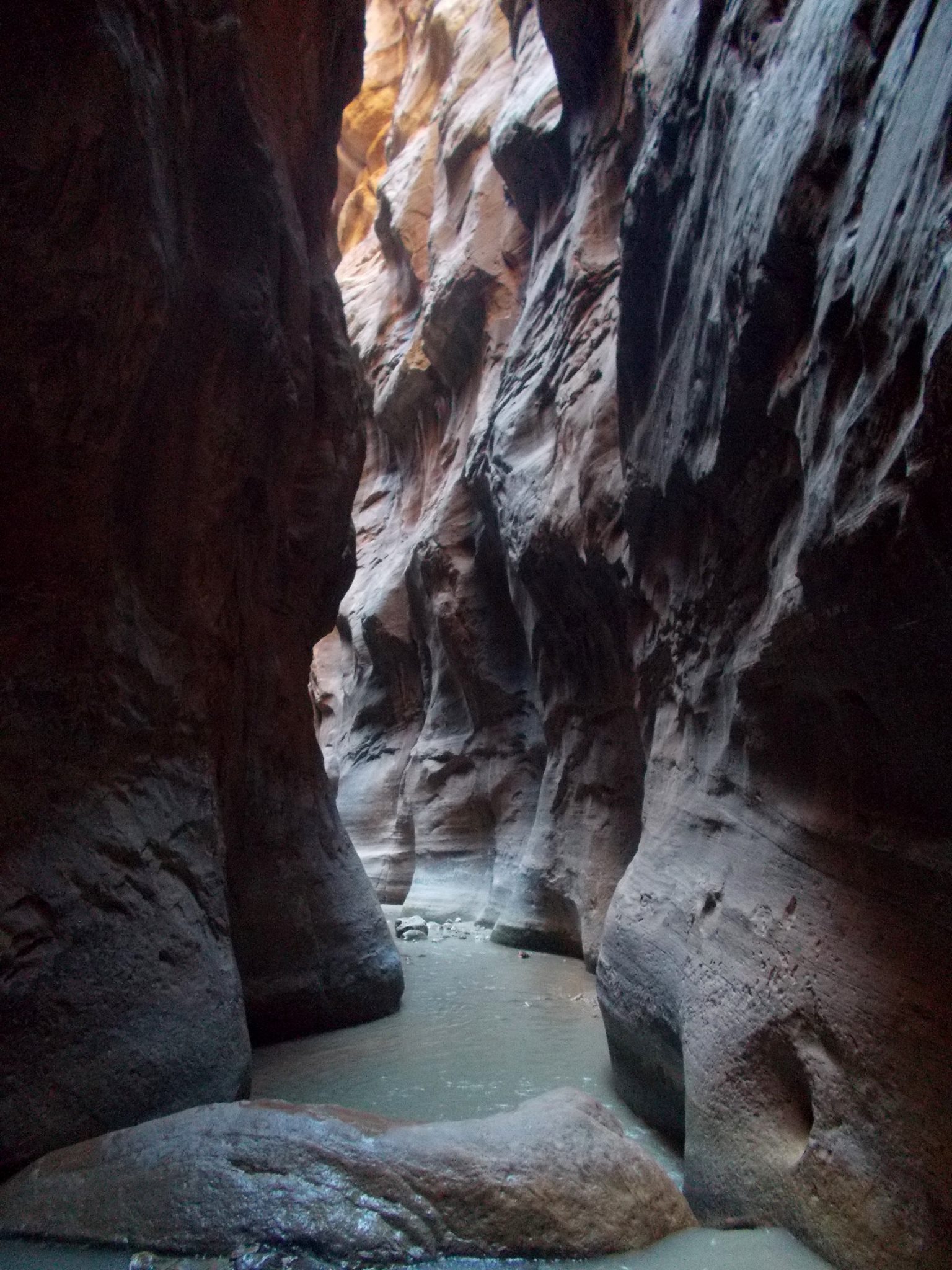
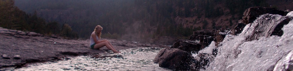
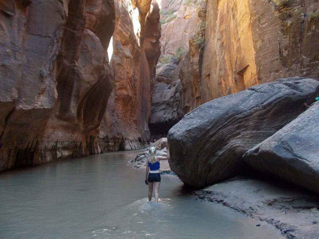
There are points when you might be waist deep in the water, so it’s advisable not to bring valuables with you on this walk. Do bear in mind however that you may be chilly after leaving the water. Nevertheless make the most of the water on your skin as the park only receives 15 cm of rainfall a year!

Angel’s Landing

This striking monolith gained its title in 1916 after the explorer Frederick Fisher claimed that”only an angel could land on it”.

1276915_10154759301230495_8715380845477574145_o

Starting from the Grotto shuttle stop on the Scenic Drive, the West Rim Trail up to the monolith is a 2 mile thigh-burning, zig-zagging route that hugs mountains of bronzed sandstone. Lizards dart between cracks in the rock only to become camouflaged against the dried leaves. A plentiful supply of sunscreen and water is essential! After a mile you’ll find shade in Refridgerator Canyon before you have to “squiggle the wiggles” and tackle a series of steep switchbacks. My partner and I foolishly decided it would be a good idea to start running up the first one, without realising how many were left…

10708508_10154759302140495_8321705842315675871_o

Many gasps for air and gulps of water later, you’ll reach the flat sandy area of Scout Lookout where you’ll see the ridged runway for Angel’s Landing begin ahead of you. Some people won’t even make it onto the trail because they are so fatigued after their sweaty uphill trek. From the start of the trail to the end point is only half a mile, but the path is steep, complex and takes time to maneuver. But for those who get a thrill from challenging routes, it’s great fun!

10694439_10154759357175495_3546547946842140435_o

At the time we did the hike (in August 2014), six people had died within the last 10 years on this trail. In a way this doesn’t seem like much when you consider the height and width of this monolith combined with the threat of heatstroke causing hikers to keel over. This hike is not for the faint-hearted. At times you will be walking along a very narrow path with a stomach-churning drop of over 1000 feet off the side, the Virgin River looking only a millimetre wide far below. Chains regularly have to be used to ascend steep slabs of rock and there are narrow crevices which you must hoist yourself up through. One of my strongest memories is the sight and smell of sweat-stained shorts as a (rather large) man’s buttocks loomed alarmingly close to my face while he struggled to squeeze through one of the thin gaps in front of me. I would not be offering to give him a push…

10380838_10154759319025495_5572660501029750572_o

Courtesy is definitely a requirement on this hike, as many times there will be not space for more than one person to pass through a certain part of the route. Those heading back from the end would offer support to approaching hikers with calls of “Not far to go!” We finally reached the summit with stunning views of the valley of Zion sprawled out before our eyes. We, the angels, had landed and it was easily one of my most fulfilling travel moments. Man-made rock piles stand proud near the cliff edge, showcasing the hiker’s achievement to the world in front. It may not have involved the elevation of Everest, but this hike had brought its own unique challenges. Gazing out at the view ahead, you can’t help but feel superhuman after this remarkable feat.

10604561_10154759326150495_1861884877953901420_o

I saw the large man produce his camera to take a photo as proof of his achievement. Whilst reaching the summit of a hike alone is very rewarding, I was grateful to be able to experience the physical and at times mental challenges of this hike with someone else, and share the subsequent sense of success. I now wish I had offered to take the man’s photo so that he is able to look back in later years at himself against this incredible backdrop and feel a great sense of pride. I did however compensate by asking a German couple if they’d like their photo taken. I particularly loved how much they appreciated me speaking their language.

It would be easy to get slightly complacent about safety on your way back along the ridge, but in your rush to finish the hike after having seen the best bit, it’s important to remain cautious and take your time. On the way back down the West Rim Trail we passed many tourists panting as they hiked up towards the monolith under the sweltering heat of the midday sun. It was definitely a good idea to set off on this hike early, to avoid both the peak sunshine and the greater numbers on the trail. When you’re back on ground level, dive into the Virgin River to cool off. You won’t even care that you’re not wearing swimsuits as your body will be so grateful for the refreshing water! It was here that we chatted with a family on vacation from Minnesota, and I began to understand better why some Americans might be so ignorant about other areas of the world, because they have so many amazing places to discover within their own huge country.

10428382_10154759349815495_1751464797134551421_o

With the amount of calories that you’ll burn off completing this tough 5-mile hike, you’re bound to feel hungry later. We drove into the village of Springdale to fill up on gas and my partner asked inside for a recommendation for lunch. We were advised to visit a Mexican restaurant around the corner called Oscar’s Cafe…and it was an excellent recommendation. This was an occasion where American food portions no longer seemed outrageous. Served by a friendly waitress, we shared a scrumptious meal of fish tacos, beef burgers and sweet potato fries. Then came dessert. We dived into the mountain of ice cream-smothered chocolate brownie devilishly, only to be distracted by the sound of a young girl on another table exclaiming to her red-faced mother: “They’re gonna get fat!” My partner conceded defeat after a few mouthfuls, but the pudding-lover in me ploughed on until the end before I sank into a food coma all afternoon.

If you love the idea of pushing your boundaries to out-of-this-world levels, definitely visit Zion National Park and chase the Angel. If you’ve been to Zion before or have any questions, please comment below!

*

More information on the Angel’s Landing trail can be found here.

If walking to the Narrows, be sure to check forecasts for flash flooding beforehand.

Searching for Nature’s Treasures in Goldstream Provincial Park

Located off Highway 1 just under 20km from Victoria on Vancouver Island, Goldstream Provincial Park is a great stop en route to Tofino and a favoured destination among locals looking for a weekend walk with their dog. Parking is free, toilets are on site, and the staff in the tiny visitor centre will point out the park’s key areas on a map.

Autumn is a lovely time to visit this park as the maple leaves have a wonderful golden glow to them when they catch the sunlight, emitting that wispy wet sound as you wander through them. I spent much time staring at the ground looking for the perfect one to take away with me. Within these lush surroundings, the only fault is the faint sound of traffic from the highway nearby.

As you walk through the tunnel that remains fom the gold rush experienced here in the mid 19th century, you’ll come to Niagara Falls (a much smaller version of its eastern twin!) with a trail beginning on the right. There aren’t many signs so further on you have to follow the sight of flattened soil which highlights a path up to the right. Scramble steeply up and after leaping a few fallen logs, you’ll eventually reach the old railway trestle which, based on the number of Facebook cover photos I’ve seen that feature them, is quite a popular place with island kids.

DSC_0051DSC_0052DSC_0054DSC_0055

The park is most famous for its salmon run which takes place in mid October until December, featuring mainly Chum salmon as well as Coho and Chinook. I saw about 12 salmon struggle upstream to lay their eggs having journeyed from the Pacific Ocean after living there for the past three years. Conquering the current is quite a battle, with splashes erupting sporadically as the fish thrash to move upwards. Nests in the gravel are known as ‘redds’ and are chosen by the female, while the male guards the area. Her eggs, known as ‘roe’ are fertilised by the male after they have been laid. After a new life has been created through all this effort, the salmon will slowly die in the place where they were born. It’s quite the sacrifice! To add salt to the wound (or perhaps highlight the significant existence of the food chain in nature), bald eagles will eagerly feed on their corpses in the spring.


DSC_0059

Some visitors will come to the park for a 60 minute refreshing walk; others will spend a day exploring. I did the former but elsewhere in the 366 hectare park you can find a range of rich vegetation including red cedar and arbutus trees, while if you crave a workout there’s the hike up 419m high Mt. Finlayson.

When surrounded by such an abundance of natural goodness, it’s a shame that some visitors couldn’t put their Starbucks cups in the many bins provided in the park. But this is the risk when nature is easily accessible to urban society and the social habits that form within. The park is in close proximity to life in the fast lane, but as photos like this one below show, it’s a great little spot for when you need a breath of fresh air.


Harming Nature Through Human Nature

In the past couple of weeks as I write this post in November 2014, a rogue artist from New York has been in the news for vandalising some of America’s national parks with artistic graffiti. As expected, this activity has been condemned by both national park rangers and the public. Type ‘lady defacing national parks’ into Google and the top searches begin with the terms ‘awful person’ and ‘terrible human’. The perpetrator has been slammed for drawing these images and uploading them to Instagram, i.e. for seeking fame and attention at the expense of nature.

I of course was also appalled when I heard about these acts , especially as I have many special memories of the magnificent topography in some of the victimised parks – including Canyonlands and Zion – that were formed only weeks before these images were drawn. But then I thought about this issue some more and asked myself: regardless of spray-paint, are tourists not already defacing the nature of the parks? Through our own desires to find fame from capturing the best photo of a wild animal, are we camera-crazy (albeit well-meaning) humans not causing harm too? Harm that is subtle and unintended in nature, but still damaging to nature’s routine.

The other day I read the George Orwell classic ‘Animal Farm’. Published in 1945 and banned in the USSR for its anti-Stalin sentiment, the beginning of the story involves the animals of a farm rising up in rebellion against their greedy human owner and establishing control of the farm themselves. As I read the (highly-recommended) novel, I thought back to the encounters I had with wildlife during my American road trip this past summer.

I thought about the Rocky Mountain goats in Glacier National Park being woken from their afternoon naps by invading tourists trying to take a photo of their babies. Often the mother goat would nudge her kid to its feet and they would trot off to find a new secret place – something hard to find on the particularly popular Hidden Lake Overlook trail. People would watch them go almost offended, as if it was an insult for an animal to reject human advances.

355

I thought about the bison in Yellowstone demanding that traffic come to a standstill while they marched across the road to new pastures. For all I know, their deep grunts were a sign of resentment towards the cars that clogged the man-made partition of their resources. I was surprised at how gentle they were; they were more than capable of causing damage to the monstrous RV that obstructed their path, by bashing their huge heads against its artificial walls in a determined declaration of  “We were here first.”

079

I thought about the regular signs on the roads of Yosemite that reminded tourists to drive carefully, citing recent bear fatalities (reports state that so far this year, the figure is at 25). How ironic that in our quest to see a bear, we actually end up killing them? We contradict the whole purpose of a national park to conserve a species. It is in Yosemite’s campgrounds that keeping food in cars is prohibited, since recently a few bears learned how to open doors. These bears were then destroyed to prevent the trait being learned by others and to avoid human casualties. But is it not humans that are invading the bears’ space, rather than vice versa?

Finally, I thought about the large group of elk on Highway 101 just outside Redwood National Park, who caused a traffic jam when they decided to block part of the road. I remembered a man with long hair who drove a VW campervan videoing the scene and asking out-loud, “What does this mean, animals blocking a man-made road?” At first I had smiled to myself at this apparent hippy-expressionism, then I realised that he actually raised an interesting question. Was this group behaviour a form of defiance against man’s interference in nature?

1466

Does our greed as humans for viewings of rare wildlife touch on the verge of exploitation? Are we not slightly reminiscent of the white man colonising sparse lands in order to generate revenue, killing native inhabitants in the process? It should be mentioned that it is because bison were brought under conservation in Yellowstone that the species was protected from poaching and was subsequently able to grow in numbers within the last century. But back when the park was established in 1872, who was to know that these animals would eventually become the target of the tourist paparazzi? For it has become human nature to stalk the world’s rarest wildlife through a lens.

Obviously tourists, including myself, want to get a close look at wildlife; it’s only human nature. Personally however, I try to respect animals’ privacy in doing so and not disturb them from their natural state. It’s the same way that I would attempt to be discreet if taking a photo of a human stranger doing something interesting, if it was a situation where asking for permission would ruin the moment. Animals have no voice to give consent and therefore cannot be ‘asked’ in the way we humans are familiar with, but that doesn’t mean they condone the behaviour.

After reading ‘Animal Farm’ and thinking about these issues, it almost seems plausible to imagine these animals calling for a revolution against us human tourists.

But then there is the issue of squirrels. At first, it’s cute and endearing when the tame, chubby ones in Zion scamper over to your feet and look up expectantly for food with their tiny paws out like Oliver Twist. Even my friend and I were at first caught in the trap of taking photos and ‘awwww’ing at them. However, you then see them picking on the skinnier squirrels, consequently depriving them of food. Like in ‘Animal Farm’, those animals that interact with humans benefit, and it becomes the case that ‘all animals are equal, but some animals are more equal than others’. If humans weren’t feeding these squirrels, the inequality within the species would be smaller. Like the British Raj in India, it seems that human tourists have cemented power through a policy of ‘divide and rule’. Perhaps if the intrusive human presence left, the animal kingdoms would disintegrate into a state of instability and corruption.

Of course, I expect many people reading to view the idea of an animal rebellion as an eccentric, far-fetched vision. But it is easy to imagine innocent things, just like it is easy to harm innocent beings. As history has shown, both are only human nature.